
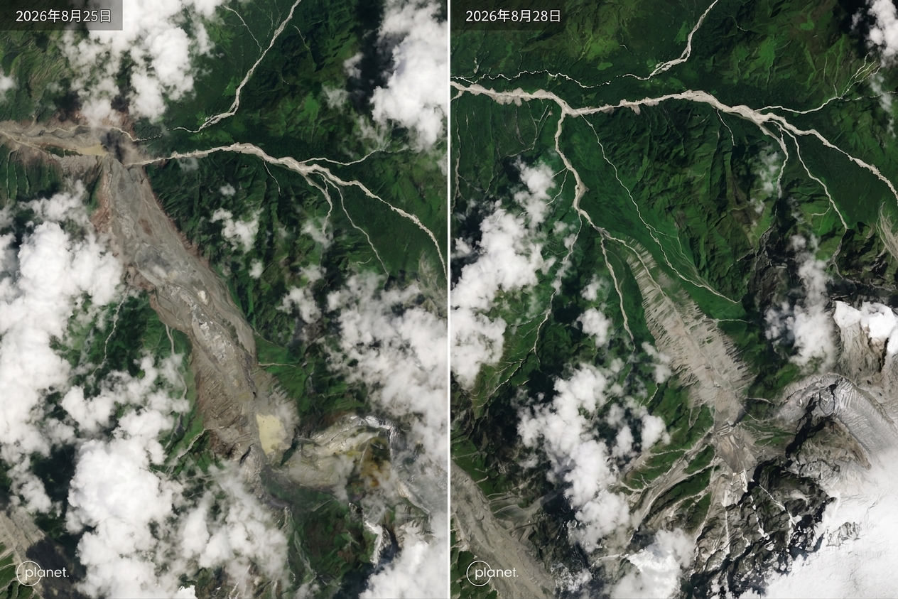
On the morning of August 26th, a severe glacier collapse occurred at Langtang Lirung Peak in Langtang National Park, Nepal, triggering a high-speed landslide and tsunami-like mudflow. The tremendous impact generated energy equivalent to a 5.2 magnitude earthquake, leading to a massive flow of ice water and debris along the Trishuli River, engulfing villages along the way and causing devastating damage to the border region between Nepal and China. The disaster has resulted in nearly a thousand deaths and thousands of people missing.
Multiple sets of satellite images have captured the awe-inspiring process of reshaping the landscape. Satellite images taken by the US company Planet Labs on August 25th and 28th showed the glacier structure of Langtang Lirung Peak intact before the collapse. After the collapse, a huge gap was left in the mountain, and a large amount of ice water and debris rushed directly down into the valley.
In the downstream river valley, a satellite composite image released by the US commercial satellite imaging and geospatial information company, Vantor, on August 27th revealed the severe impact on ground infrastructure. The village of Syapru Besi in Nepal’s Rasuwa district, the Pasang Lhamu Highway, and the Trishuli Bridge area, where the river channels and buildings were clear before the disaster, have now been submerged by muddy mudflows, with the river channel significantly widened and bridges and roads severely damaged.
Furthermore, as an important corridor for trade and personnel exchanges between China and Nepal, the Gyirong Port and Rasuwagadhi Border Checkpoint were also severely affected by the disaster. Post-disaster satellite images showed that the raging floodwaters and mudflows directly engulfed the port facilities, swallowing up the infrastructure in the border region.
Short-wave infrared images from the Copernicus Sentinel-2 and the US Landsat-9 satellites further revealed that the surge of water caused by the glacier collapse flowed through steep gorges, leading to massive landslides. Despite rescue teams working tirelessly in extreme weather conditions and muddy terrain, the interruption of traffic and the ongoing risk of landslides have made rescue operations a daunting challenge. Satellite data will continue to provide crucial information for post-disaster damage assessment and reconstruction planning.