
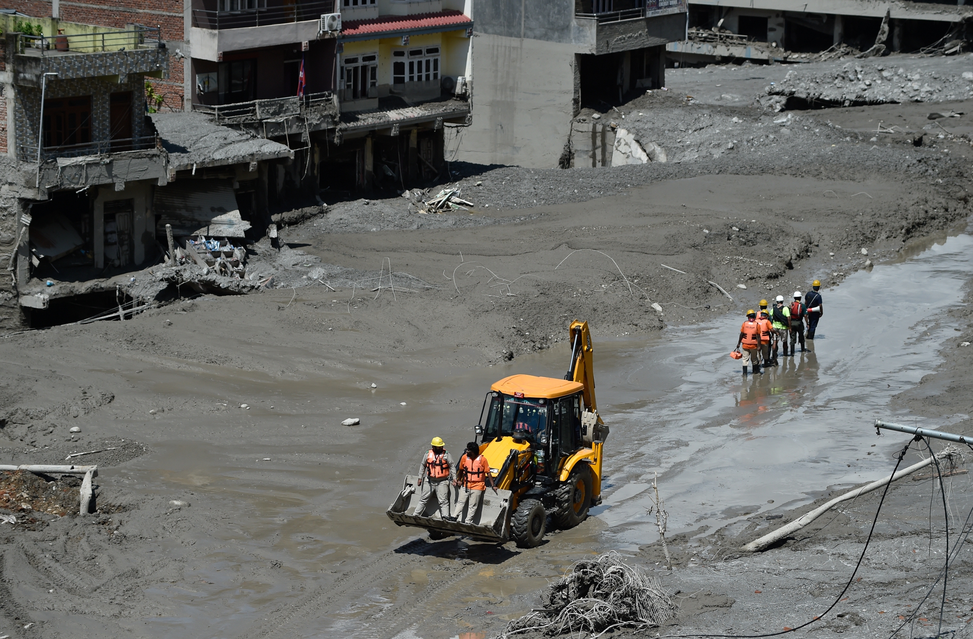
Tibet Witnessed Severe Mudslide Disaster in Jiulong County, Shigatse City
Recently, Jiulong County in Shigatse City, Tibet, experienced a serious mudslide disaster. According to the forecast by the China Meteorological Administration on August 31, the local area is expected to receive rainfall for the next three days with accumulated precipitation of 10 to 35 millimeters. Continuous rainfall may further exacerbate the situation of barrier lakes in the disaster area.
As of August 31, the latest data released by the National Disaster Reduction and Disaster Management Agency of Nepal showed that 903 people have died and 4,247 people are missing on the Nepalese side. On the Chinese side, the official report stated that 16 people have died and 546 people are missing in Jiulong County, Tibet. The combined death toll in both countries is 919, with 4,793 people missing, including a large number of foreign tourists and hydropower workers.
This disaster unleashed a massive amount of ice, snow, rocks, mud, and flood waters rapidly descending through the Himalayan valleys. Along the way, roads, bridges, villages, hydropower facilities, and the China-Nepal border crossings have all suffered severe damage.
Current satellite images and geological analysis indicate that this disaster is not just a typical flash flood, but a “compound disaster” formed by high-altitude glaciers, mountain collapses, and flooding cascading together.
The United States Geological Survey (USGS) preliminary analysis suggests that on August 26, a large-scale instability occurred on a high-altitude mountainside near the China-Nepal border in Langtang National Park, Nepal. This instability involved the sudden collapse of a glacier slope, leading to a massive rush of ice, snow, rocks, and debris falling rapidly, forming huge mudslides and floods upon entering the river valley. This flood surged downstream nearly 100 kilometers, eventually affecting areas such as the Jiulong border crossing at the China-Nepal border.
Reuters cited satellite images and expert analysis, indicating that the suspected collapsed glacier was located at an altitude of about 5,200 meters. After a significant portion of the glacier collapsed, it fell about 1,200 meters and carried a large amount of rocks and soil during its descent, eventually resulting in a devastating ice-rock avalanche and mudslide.
Nepalese assessments show that the flood extended downstream for approximately 168 kilometers, with around 57.4 million cubic meters of water engulfed downstream. At least 19 bridges and about 40 kilometers of roads have been destroyed, causing severe damage to several hydropower projects.
Satellite images revealed a significant contrast in the landscape before and after the disaster.
According to a report by Asahi TV, the US-based Earth observation company “Planet Labs” publicly released satellite images of the Nepalese disaster area on August 25 and August 28.
The images show that on August 25, a day before the landslide occurred, the glacier valley was lush with vegetation, and multiple rivers flowed along the valley. But by August 28, the terrain in the disaster area had undergone significant changes. The formerly scattered rivers appeared to converge, and vast slopes were covered with mud and debris, exposing large brown mountainous terrain.
The satellite images also revealed a massive white face at the suspected glacier collapse site that did not exist before the disaster. These changes corroborate with geological analyses, suggesting that the source of the disaster likely originated from the high-altitude glaciers and unstable mountain slopes.
The US Geological Survey further stated that the energy generated by the slope instability was equivalent to approximately a 5.2 magnitude earthquake.
The satellite images also showed the formation of several barrier lakes around the disaster area. After the mudslide blocked the original river channels, the river water was intercepted and accumulated in low-lying areas, forming natural dams and lakes.
The water level and area of some lakes have started to decrease, with some lake beds re-emerging, but another larger lake is still under continuous monitoring.
On August 31, the China Meteorological Administration predicted that Jiulong County will continue to experience rainfall for the next three days, with accumulated precipitation of about 10 to 35 millimeters. Northwestern to eastern Tibet and western Sichuan will also receive rainfall, with some areas in southeastern Tibet possibly experiencing moderate to heavy rain and local heavy rainfalls.
The meteorological department warns that continuous rainfall may raise river and lake levels, further aggravating the situation of barrier lakes.
According to a news report by CCTV, in the disaster-stricken area of Jiulong, Tibet, the remnants of the rocks washed by the flood are estimated to be as high as about 60 meters, equivalent to a 20-story building, and the river channel remains severely damaged.
This deadly mudslide, claiming nearly a thousand lives, swept down in just 30 minutes, destroying everything in its path, leaving behind a scene of devastation. It once again reminds people of the tremendous power of nature. Netizens expressed their astonishment, “Humans are so insignificant in the face of nature!”