
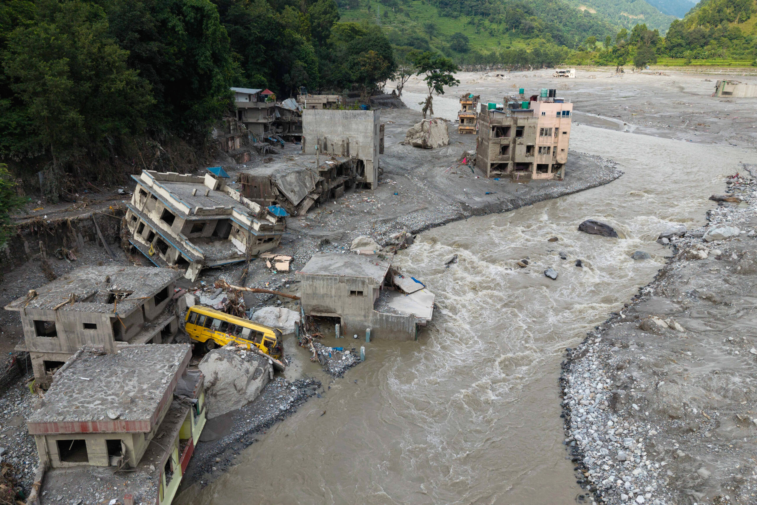
A severe flash flood occurred in the border area between Nepal and Tibet, China on August 26th, revealing a chain of high mountain disasters rather than a simple flooding event. The latest analysis indicates that the disaster was a result of a cascade of mountain disasters triggered by various factors, drawing attention to China’s large-scale infrastructure construction in the Himalayas.
As of Monday (August 31st), the disaster has claimed over 900 lives and nearly 5,000 people remain missing.
Indian strategic scholar, writer, and professor of strategic studies, Brahma Chellaney, believes that while the disaster was triggered by natural factors such as glacier and rock collapses on a massive scale, China’s ongoing road, border infrastructure, and river projects in the upstream region of the Sino-Nepal border have altered the local valley and river environment, magnifying the destruction caused by the floods.
Chellaney’s views were reported by the Indian daily “The Statesman” on August 28th. He summarized the event as “upstream engineering, downstream disaster,” suggesting that natural disasters may evolve into larger-scale “chain disasters” after passing through human-altered mountain environments.
The disaster occurred near the border between Tibet and Nepal, with an initial massive ice-rock avalanche hitting the high-altitude region on the north side of the Langtang Range in Nepal, close to the Chinese border. Weather conditions were clear on the day the disaster struck despite it being the monsoon season in Nepal.
A large ice glacier and rock mass at an altitude of approximately 5,200 meters suddenly collapsed, triggering an ice-rock avalanche that sent a huge amount of ice, rocks, and debris into the river system, leading to intense flooding and debris flow.
Following the disaster, the flood rapidly surged downstream along the valley, impacting roads, bridges, and border facilities near the Sino-Nepal border.
Chellaney points out that the issue lies not only in the scale of the flood itself but also in how the topography and river channels in the Himalayan valleys have increasingly been influenced by human engineering over the years.
Over the past decade, China has constructed embankments and other civil engineering projects along riverbanks and in narrow valleys near the Nepal border in Tibet. While originally intended to protect infrastructure and improve transportation, these constructions could pose problems during extreme flood events. Concrete embankments and altered riverbanks may restrict the natural space for floods and debris dispersion.
During the Nepal flood disaster, swift waters carried rocks, soil, concrete debris, machinery, and other debris downstream, intensifying the impact on villages, roads, and bridges.
According to Dr. Chellaney’s report, China has been building and expanding roads, border facilities, and other infrastructure in the region to enhance transportation and trade. Infrastructure construction around the “Gyirong Port,” near the Sino-Nepal border, is cited as an example of local development activities.
While these projects may improve normal traffic, trade, and infrastructure conditions in border areas, Chellaney argues that large-scale construction in narrow Himalayan valleys has also altered the natural flow patterns of the terrain and rivers.
For example, diversion dams and water intake facilities have changed the flow of water in the narrow Himalayan gorges. Chellaney suggests that these changes could create localized “bottlenecks” and secondary blockage points, especially when an unusually high volume of floodwater, silt, and debris suddenly enters the river system, potentially exacerbating the situation.
Concerningly, when floods encounter extensively altered river channels, a natural disaster could escalate into a more destructive catastrophe as the related facilities may be damaged or unable to withstand the flood impact, leading to more debris being carried downstream, intensifying the force of the water flow.
Another issue of concern is the sharing of hydrological data.
China has hydrological monitoring stations in the upstream source areas of Tibetan rivers, allowing them to track river levels and conditions in the upstream region.
Chellaney expresses concerns about the lack of comprehensive, year-round, and real-time sharing of hydrological data and emergency warning mechanisms between China and Nepal.
In situations where floods rapidly escalate, such information could be crucial. Early issuance of warnings could provide downstream communities with more time to evacuate and enable authorities to take timely measures to protect critical infrastructure. Nepal hopes to gain access to real-time data on glacier activity, avalanches, and other immediate information within China’s territory and establish a more robust cross-border warning system.
While natural disasters like avalanches, glacier activity, and flash floods cannot be entirely prevented, changes in river and mountain landscapes post-engineering projects may influence the extent of the destruction caused by these disasters downstream.