
Meteorologists and scientists have indicated that there may be an El Niño phenomenon occurring this summer, as the La Niña phenomenon that persisted throughout the winter is expected to fade away, paving the way for a strong El Niño event that is projected to reshape the global weather patterns in 2026.
According to Zeke Hausfather, a research scientist at the U.S. non-profit temperature monitoring organization Berkeley Earth, almost all global forecast models suggest the formation of the El Niño phenomenon in the coming weeks. The models indicate that this could be a “quite strong event,” potentially ranking among the strongest El Niños in recent history.
The possibility of a strong El Niño event has raised concerns that summer temperatures this year may be higher than normal. Such an event could trigger a chain reaction in the upcoming months, leading to various effects on weather patterns globally.
El Niño has previously exacerbated wildfires, caused severe flooding, and triggered massive droughts. This climatic phenomenon has also resulted in widespread coral bleaching and disrupted the migration and feeding activities of marine life.
However, it is important to note that these are still early indications, and the uncertainty remains as to whether El Niño will indeed manifest this summer.
The U.S. National Oceanic and Atmospheric Administration (NOAA) stated in its April update report that there is a one in four chance of a strong El Niño event occurring. Subsequent to this report, ocean surface temperatures associated with El Niño have been on the rise. The next update report from NOAA is scheduled for May 14.
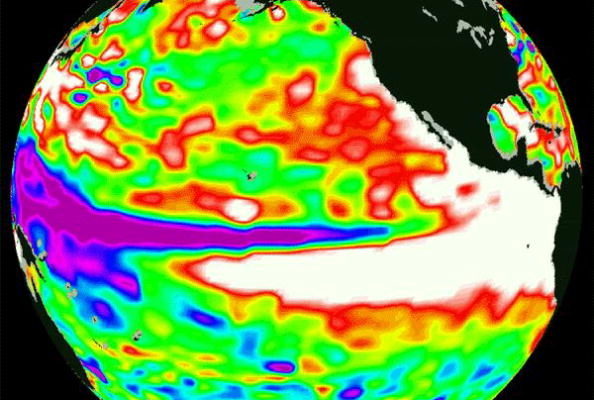
El Niño, officially known as the El Niño–Southern Oscillation (ENSO), is part of a natural climate cycle. This cycle results in fluctuations in sea surface temperatures in the tropical Pacific Ocean near the equator, with El Niño characterized by sea surface temperatures higher than the average norm by 0.5 degrees Celsius, while La Niña shows temperatures lower by 0.5 degrees Celsius. When the sea surface temperatures fall between these thresholds, it is referred to as a “neutral” state.
According to the Cooperative Institute for Research in Environmental Sciences at the University of Colorado, Boulder, the El Niño–Southern Oscillation phenomenon “is perhaps the single most influential climate driver on Earth.”
Due to the vast expanse of the Pacific Ocean, disturbances in its waters can have far-reaching impacts, affecting the release of oceanic heat into the atmosphere, atmospheric circulation, temperatures, and precipitation worldwide.
The La Niña phenomenon that prevailed throughout the winter has dissipated as of early April. While its effects on drought conditions in certain U.S. regions may persist, meteorologists widely anticipate the onset of El Niño in the coming weeks. Satellite data has shown a significant increase in sea surface temperatures in the central and eastern Pacific Ocean in April.
However, NOAA has not yet declared the presence of El Niño solely based on above-normal sea surface temperatures. It requires sustained temperatures significantly higher than the average for a period of time, alongside accompanying weakening trade winds and corresponding atmospheric changes.
Although weather forecasters and global prediction models have identified some factors suggesting an elevated likelihood of a strong El Niño event, the potential intensity of this upcoming El Niño event remains to be observed.
Brian McNoldy, a senior researcher at the University of Miami, shares a similar perspective, stating that discussions regarding the development of a strong El Niño are prevalent. While models are currently aligned in their projections, the consensus is that this will be a “common” strong El Niño event, rather than a historic one.
NOAA stated in April that the final outcome will hinge on the wind patterns in the equatorial Pacific during the summer.
One significant impact of the El Niño phenomenon is the reduction in tropical activity in the Atlantic. Changes in the jet stream over the U.S. can lead to sinking air and downwelling winds, which are known to suppress, though not eliminate, the formation of hurricanes in the main region of the Atlantic where hurricanes frequently develop. These downwelling winds can hinder the establishment of the self-sustaining structure necessary for a storm to develop into a hurricane.
However, institutions like the National Hurricane Center have cautioned that even in years when El Niño occurs, storms – including potentially highly destructive major hurricanes – could still arise, particularly in the Gulf of Mexico region.
(Adapted from a report by USA Today)