
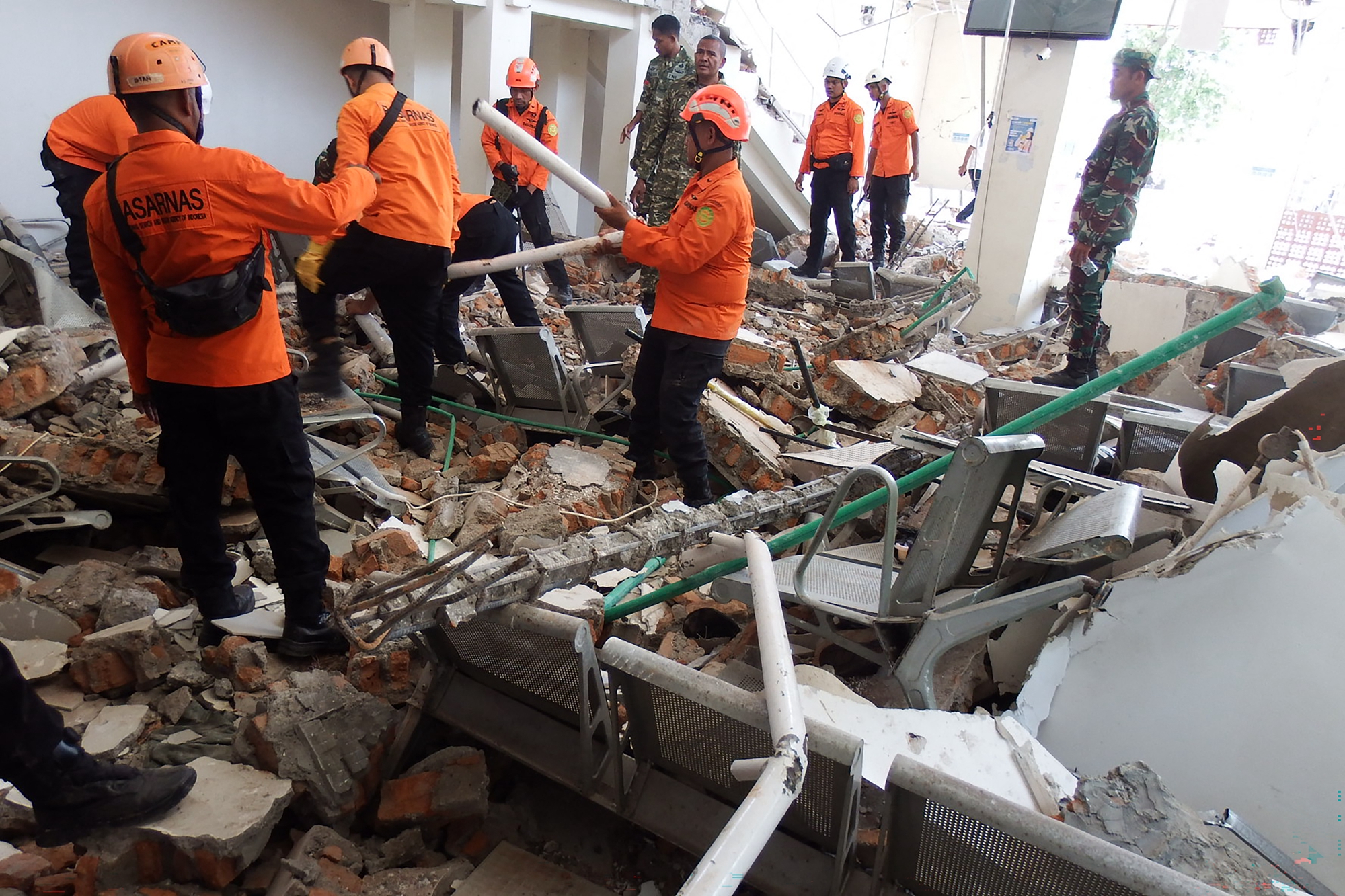
On Saturday morning, a 7.7 magnitude earthquake struck near Flores Island in eastern Indonesia, resulting in at least 47 fatalities. It was reported that multiple individuals were buried or went missing due to landslides, hindering rescue personnel from accessing the affected communities.
Rescue workers are still searching for survivors trapped under the rubble of damaged buildings. Additionally, the emergency response department warned that as rescue teams venture into remote areas, the count of casualties may rise.
On the other hand, due to damaged infrastructure and blocked roads, rescue teams face significant operational challenges. Meanwhile, medical staff are transporting emergency relief supplies and evacuating injured residents to local hospitals.
As such, government agencies have initiated a comprehensive assessment of the losses to determine the earthquake’s overall impact on local communities. Currently, the focus of emergency relief efforts is ensuring the safety of displaced families and restoring basic public services.
This disaster highlights the ongoing vulnerability of the region due to its location in the Pacific Ring of Fire. In 1992, Flores Island also experienced a devastating 7.8 magnitude earthquake, resulting in approximately 2,000 fatalities.
European Commission President von der Leyen stated on Saturday that following the 7.7 magnitude earthquake in Indonesia, the European Commission is preparing to provide support for Indonesia’s rescue operations through the Copernicus program, offering “eyes in the sky.”
Von der Leyen posted on the social media platform, “Indonesia, we stand with you.”
The Copernicus program is an observation system that utilizes the Sentinel satellite series to provide mapping services that assist in search and rescue operations and disaster assessments.
Officials from the diplomatic departments of Italy, Greece, and Estonia also posted messages of support on social media platform X.
Earlier this week, the European Commission provided €2.1 million in aid to Colombia and deployed the Copernicus program system to support rescue efforts following a 7.4 magnitude earthquake.
Suharyanto, the head of Indonesia’s National Disaster Management Agency, announced at a press conference held in Jakarta that over 2,000 people have been evacuated from their homes.
Suharyanto stated that landslides have blocked roads, causing severe damage to public infrastructure in the area, including five airports. Houses in several regions have also sustained extensive damage.
Although the epicenter was offshore, approximately 700 kilometers east of the popular resort destination of Bali, strong tremors were felt in the northern South Sulawesi and Southeast Sulawesi provinces hundreds of kilometers to the north.
Suharyanto emphasized the urgent need to restore local electricity and communication networks, including deploying satellite internet services.
Indonesia’s Meteorology, Climatology, and Geophysics Agency (BMKG) previously issued a tsunami warning, which was lifted two hours later. So far, the agency has recorded over 235 aftershocks, with four measuring above 5.0 in magnitude. Aftershocks are expected to continue for two weeks.
According to Reuters, rescue teams discovered 20 deceased individuals and six injured individuals under the rubble in Maumere port town, located in Sikka Regency on Flores Island, eastern Indonesia. It is reported that rescue personnel have not yet reached some remote areas near the epicenter.
Videos circulating on social media show that Laurentius Say Port in Sikka Regency, Maumere, appears to have suffered damage during the earthquake. A video filmed from a departing ship shows the gangway suddenly collapsing into the water, leading to at least one person falling overboard as residents panic.
BMKG official Nelly Florida Riama mentioned during a Saturday morning press conference that the earthquake was caused by back-arc thrust faulting in the Flores Sea.
Back-arc thrust faulting refers to the reverse faulting structural movement located in convergence zones of tectonic plates, island arcs, or the backside of a volcanic arc (i.e., the side away from the trench). This activity often accompanies severe crustal shortening, thickening, and seismic activity.
The Geological Agency of the Indonesian Ministry of Energy and Mineral Resources stated that groundwater emerged post-earthquake, indicating possible soil liquefaction.
Acting Agency Chief Lana Saria mentioned on Saturday afternoon, “However, this sign has not been confirmed yet and has moderate to low reliability.”
Flores Island is home to 15 volcanoes, including Mount Lewotobi Laki-laki. This volcano experienced a large-scale eruption in November 2024 and is reportedly still active this week.
Saria attempted to reassure the public regarding speculations of potential volcanic activity triggered by the earthquake.
“Although seismic instruments detected the earthquake this morning, there is no correlation between the earthquake and volcanic activity,” she said.
Suharyanto mentioned that East Flores Regency, where Mount Lewotobi Laki-laki is located, was not affected by the earthquake on Saturday morning. The agency responsible for disaster relief will redistribute some emergency supplies stored near the volcano to the earthquake-affected areas.
Indonesia is situated on the Pacific Ring of Fire, making it highly susceptible to earthquakes and volcanic eruptions. The country is home to 127 active volcanoes.