
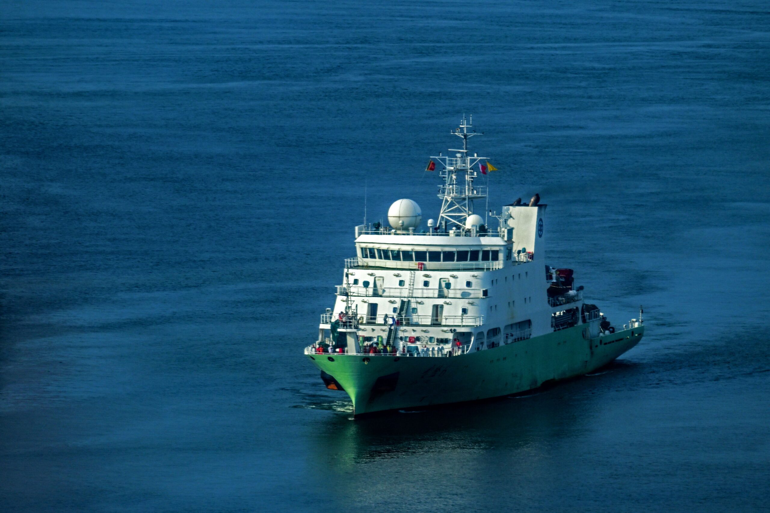
According to a report released by the U.S. think tank Center for Strategic and International Studies (CSIS) on Thursday, which analyzed the tracks of 223 research vessels from 48 countries, it was found that Chinese research vessels had significantly higher activity near important undersea facilities in international waters, particularly in 2024. The research suggests that the data collected could be used for submarine warfare and potentially provide intelligence for disrupting undersea communication facilities.
The report indicates that China is utilizing research vessels with dual military and civilian functions to collect oceanic data of military value under the guise of scientific research. These activities pose potential risks to the communication and naval operations of the United States and its allies in the Indo-Pacific region.
To address this, CSIS recommends that the U.S. and its allies enhance cross-border intelligence sharing, establish joint maritime patrol mechanisms, and expand undersea cable maintenance capabilities to enhance deterrence and the resilience of communication systems.
Titled “China’s Weaponization of Dual-Use Research Vessels for Undersea Data Dominance,” the study was conducted by CSIS’s Futures Lab and analyzed Automatic Identification System (AIS) data from vessels between January 1, 2020, and December 9, 2025.
Comparing the activities of research vessels from China, the U.S., Russia, and 45 other countries, the research team found that Chinese research vessels spent a significantly higher proportion of time near key undersea facilities like undersea cables in international waters compared to most other nations.
The study identified that for four years, Chinese research vessels were among the top 20% most frequent in their activities near critical undersea infrastructure in international waters. This trend was particularly pronounced in 2024, with seven Chinese research vessels entering this category.
Researchers suggest that China may be utilizing civilian research vessels to gather data on undersea topography, water temperature, salinity, and currents to prepare for submarine operations, military surveillance, and potential disruptive actions.
The report specifically analyzed the activities of two Chinese research vessels, including the Xiang Yang Hong 06, which conducted intensive surveys in the vicinity of multiple undersea cables near Guam, an important military base for the U.S.
From February to May 2024, the Xiang Yang Hong 06 went to the waters outside of Guam and conducted intensive mapping about 210 nautical miles away from Guam in a pattern resembling a back-and-forth grid (commonly known as the “mowing machine pattern”). Its activities covered the APRICOT Cable System route, which was not operational at the time, and the Asia-America Gateway (AAG) undersea cable system. These cables connect Taiwan, Japan, Guam, Southeast Asia, and the U.S., forming a crucial communication network for the Indo-Pacific region.
In July of the same year, the vessel was once again active in the waters east of Guam, surveying areas involving the AAG, the Southeast Asia-United States (SEA-US) undersea cable system, and the planned Asia-Pacific Cable Network-1 (ACC-1) route.
From August to October, the vessel further expanded its investigation range.
CSIS noted that initially, the Xiang Yang Hong 06’s mapping activities were not in areas known for high potential of critical mineral exploration but were concentrated near important undersea cables. These cables are not owned or operated by mainland Chinese companies.
The report suggests that these features indicate that the vessel may be more focused on gaining control of strategically significant undersea facilities rather than solely conducting mineral research.
Guam serves as a vital logistical and forward deployment base for the U.S. military in the Second Island Chain. Any disruption in undersea cable communication could potentially affect troop movements, logistics support, and operational coordination for U.S. forces in the Pacific.
Another research vessel of interest is the Ke Xue.
From March to June 2024, the Ke Xue carried out repeated surveys in the waters near Japan’s Oki-no-Tori-shima, with its route coming close to or crossing the TGN-IA, APRICOT, and JUPITER undersea cable systems. These cables connect Japan, Taiwan, the Philippines, the U.S., and other Asian regions.
In July of the same year, the Ke Xue headed north, passing through the Sea of Japan and Tsugaru Strait into the Bering Sea, approaching multiple undersea cables linking East Asia and North America.
One unexpected discovery was that in the international waters near the Bering Sea, it appeared that the vessel conducted mapping activities near the Russian government-owned Polar Express submarine cable.
CSIS stated, “This finding is unexpected and indicates that China (PRC, CCP) likely intends to conduct intelligence gathering, surveillance, and reconnaissance on Russia’s undersea communication facilities.”
Furthermore, during its return journey, the Ke Xue briefly stopped transmitting AIS signals east of Shemya Island, around 40 nautical miles away, and reappeared about 30 nautical miles from its last reported position approximately three hours later.
Shemya Island hosts the U.S. Eareckson Air Station, an important facility for the U.S. military in the North Pacific.
Researchers believe that these tracks indicate that the activities of Chinese research vessels are not confined to a single maritime region but encompass multiple strategically important undersea communication channels.
CSIS pointed out that approximately 99% of global international data communication relies on undersea fiber optic cables, involving estimated daily transaction amounts of $22.4 trillion.
These undersea cables not only support global financial and commercial activities but are also crucial for military communication for the U.S. and its allies.
In case of a conflict, the disruption of vital cables could weaken the connections between U.S. mainland and overseas bases, impacting intelligence transmission, troop deployments, and joint operations.
While satellite communication can serve as an alternative, its bandwidth is much lower than that of undersea fiber optic cables and cannot fully accommodate the existing communication volume.
On the other hand, undersea cable maintenance often takes several days to months, with insufficient professional maintenance vessels and complex multinational permit procedures that could prolong communication disruptions.
The report also pointed out that the United Nations Convention on the Law of the Sea allows for mapping and data collection in international waters, enabling research vessels to continue their activities near important undersea facilities without prior consent from coastal states, unlike conducting marine scientific research in exclusive economic zones of other countries.
In response to such gray zone activities, CSIS advocates for the establishment of more effective maritime deterrence mechanisms by the U.S. and its allies, integrating intelligence monitoring, joint enforcement, and communication restoration capabilities to reduce the risk of damage to undersea infrastructure.
The report recommends setting up an international “Anti-Gray Zone Maritime Action Forum” in Europe and the Indo-Pacific region, integrating ship tracking, satellite monitoring, and maritime intelligence from various countries to analyze and publicly expose suspicious activities of Chinese and Russian vessels regularly.
Currently, the U.S. and its allies have established multiple maritime security cooperation mechanisms, including the “Indo-Pacific Maritime Domain Awareness Partnership” (IPMDA) driven by the U.S., Japan, India, and Australia and the European Maritime Safety Agency’s Common Information Sharing Environment (CISE).
CSIS believes that the next step should be to connect these scattered regional mechanisms, establishing a more comprehensive monitoring network that enables countries to identify abnormal ship tracks early and elevate the costs of Chinese and Russian gray zone actions through public evidence.
CSIS recommends that the U.S. Coast Guard should lead the establishment of the “International Infrastructure Security Exchange Mechanism” (IISX), combining resources from NATO allies and Indo-Pacific partners to conduct joint patrols in international waters near critical undersea infrastructure.
Participating countries can share monitoring data, coordinate sea and air patrols, maintain constant deployments in sensitive areas, and swiftly take appropriate actions upon detecting suspicious activities.
Such collaboration can help countries share the burden of surveillance and enforcement, broaden maritime surveillance coverage, and enhance deterrence against gray zone actions.
The report suggests that in addition to preventing cable damage, the U.S. and its allies must ensure rapid communication restoration in times of crisis.
CSIS proposes establishing a regional repair center in the Indo-Pacific region, investing in quickly deployable repair equipment and forming a multinational, safety-reviewed professional undersea repair fleet.
Countries should also coordinate emergency response plans, simplify repair permits and related legal procedures to avoid delays in restoration due to administrative obstacles after communication interruptions.
CSIS believes that these three measures, when combined, can enhance deterrence through monitoring and disclosure, as well as increase the resilience of critical undersea communication facilities during crises and conflicts.
In fact, previous investigations have revealed that China is actively collecting strategically valuable undersea data on a large scale. On March 24 of this year, Reuters published an independent investigation that utilized a separate ship tracking system to analyze the tracks of 42 Chinese research vessels over five years, uncovering extensive undersea mapping and monitoring activities by China in the Pacific, Indian, and Arctic Oceans.
Among them, the Dong Fang Hong 3, operated by Ocean University of China, repeatedly navigated important sea areas near Taiwan, Guam, and the Indian Ocean between 2024 and 2025, and even inspected Chinese ocean sensors deployed near Japan.
Reuters pointed out that China is advancing a monitoring project named the “Transparent Ocean,” aimed at mastering marine data collection on factors such as temperature, salinity, currents, and underwater activities through the deployment of sensors, buoys, and undersea observation arrays.
This project, proposed by Wu Lixin, a scientist at Ocean University of China, around 2014, initially began in the South China Sea and later expanded to the Pacific and Indian Oceans. China has deployed hundreds of sensors and related equipment east of Japan, east of the Philippines, and around Guam.
Ryan Martinson, a China maritime strategy specialist at the U.S. Naval War College, highlighted that China’s related actions pose a threat to the U.S. Navy’s long-standing advantage in understanding the maritime operational environment.
Recently, new developments have surfaced around Taiwan.
On October 8, Reuters cited a surveillance report from Taiwan’s ANJET Air Service, which revealed that in mid-August this year, the company’s reconnaissance aircraft spotted the Chinese research vessel Xiang Yang Hong 3, the coast guard vessel 2502, and a fishing boat identified as having Chinese maritime militia affiliation, Min Fu Ding Yu 07902, off the coast of Hualien.
The three vessels were within a radius of approximately 10 nautical miles. This marks the first known discovery of such maritime militia vessels in Taiwan’s eastern waters.
The Taiwanese Ministry of National Defense believes that China is expanding its maritime activities under the guise of law enforcement and scientific research to create an illusion of jurisdictional control. Taiwanese officials also speculate that these activities may involve maritime blockade exercises.
Earlier on August 27, Agence France-Presse reported based on satellite imagery and vessel signal analysis that the Xiang Yang Hong 3 had navigated over deep-sea trenches and above undersea telecommunication cables around Taiwan. Experts suggest that these activities may aim to gather hydrological data for use in anti-submarine warfare.