
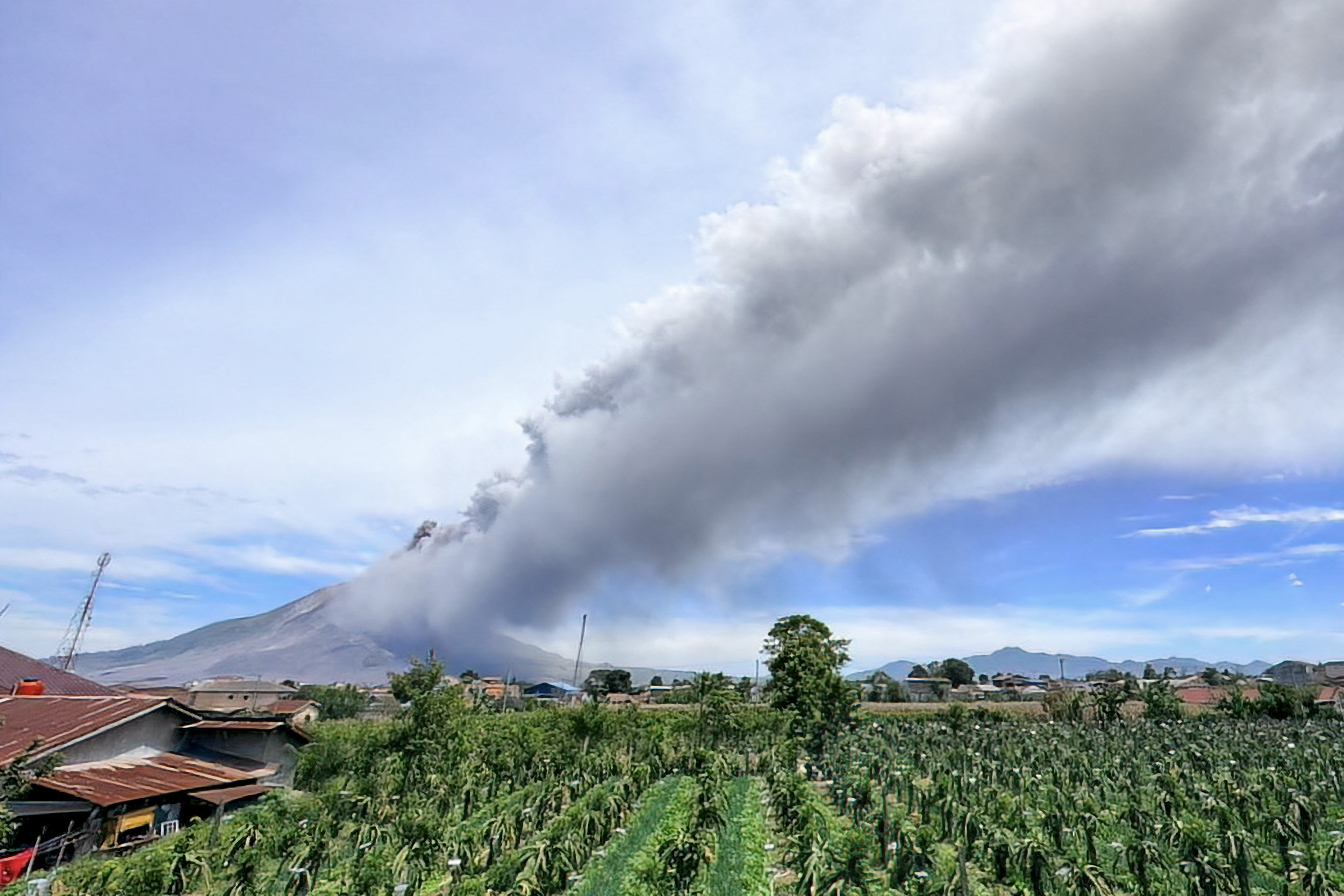
Mount Sinabung, located in Karo Regency, North Sumatra Province, Indonesia, experienced a large-scale eruption on Monday, August 31st. The volcano spewed a massive column of black volcanic ash reaching a height of 3,500 meters. Authorities have raised the volcano alert level and warned of the possibility of even larger eruptions to follow.
The Indonesian Volcanology and Geological Hazard Mitigation Center (PVMBG) reported that the eruption occurred around 10:17 am on Monday, ejecting dense columns of volcanic ash and smoke into the sky up to approximately 3,500 meters high, drifting towards the east and southeast.
Lana Saria, the head of the Geological Agency of the Indonesian Ministry of Energy and Mineral Resources, stated on the same day, “This is classified as a primary or early-stage eruption, with the possibility of larger eruptions in the future.”
Data monitored by the Geological Agency indicated that the eruption recorded a maximum amplitude of 120 millimeters on seismographs. Prior to the eruption, increased volcanic activity had been observed at Mount Sinabung, with the agency recording a total of 85 volcanic earthquakes.
As of now, there have been no reports of casualties or property damage, and flight services in the area remain unaffected. However, roads, vehicles, and buildings in several surrounding villages have been covered by gray volcanic ash, including the famous tourist mountain town of Berastagi. Local authorities have distributed masks to residents as a precautionary measure.
Meanwhile, the scenic volcanic lake located at the foot of the volcano, Lake Lau Kawar, and an adjacent camping site have been indefinitely closed.
Based on visual and instrumental monitoring results, the Geological Agency decided to raise the alert level of Mount Sinabung from level two to level three starting from 12:30 pm on August 31st (out of a scale of four levels). The volcano had been at level two since May 17, 2023.
Under the level three alert status, residents and tourists are prohibited from activities within a 3-kilometer radius from the volcano crater and are not allowed to enter a fan-shaped area extending 6 kilometers to the south-southeast of the volcano. Authorities also urge residents living near the rivers originating from Mount Sinabung to remain vigilant against potential hazards like lava flows.
Saria, the head of the Geological Agency, affirmed that continuous monitoring of Mount Sinabung’s activity will be maintained. Regular assessments and reevaluations of the volcano’s status will be conducted to guide disaster preparedness efforts. The agency also encourages the public to stay calm, remain vigilant, and follow the instructions issued by the North Sumatra Provincial Disaster Management Agency and the Karo Regency Disaster Management Agency.
Standing at an altitude of 2,460 meters, Mount Sinabung is one of the most active volcanoes in Indonesia. After approximately 400 years of dormancy, it reactivated in 2010 and has since experienced multiple eruptions, with the most recent one occurring in 2021. Since mid-August this year, white and gray smoke continues to emanate from the main crater of Mount Sinabung.