
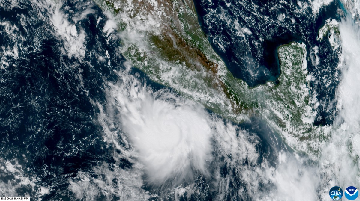
The East Pacific Ocean is currently experiencing an unusually active hurricane season. Tropical Storm “Polo” has undergone “extreme rapid intensification” from Monday to Tuesday (September 21 to September 22) due to the warm sea surface temperatures and atmospheric conditions brought by the super El Niño, becoming a rare Category 5 super hurricane with maximum sustained winds reaching 165 miles per hour.
According to the information from the National Hurricane Center (NHC) in the United States, the standard for extreme rapid intensification is when wind speeds increase by 58 miles per hour or more within 24 hours. However, “Polo” saw its wind speed skyrocket by 110 miles per hour (about 177 kilometers per hour) within a 24-hour period, rapidly escalating from a 50-mile-per-hour tropical storm directly to a monstrous Category 5 hurricane with winds exceeding 160 miles per hour.
The NHC stated that this speed was “extremely impressive,” ranking as one of the fastest strengthening hurricanes ever recorded in the East Pacific, second only to Hurricane “Patricia” in 2015 (which intensified by 120 miles per hour in 24 hours) and comparable to Hurricane “Otis” in 2023, which severely impacted Acapulco, Mexico.
The center of “Polo” is located several hundred miles south of Manzanillo, Mexico. It is expected that as the storm center moves northwest along the western coast of Mexico, it will remain over the ocean without making direct landfall. Nevertheless, its vast outer circulation will still bring severe weather disasters.
Tropical storm warnings have been issued along the southwestern coast of Mexico, with precautionary closures of ports in Acapulco, Zihuatanejo, and other coastal areas, and school closures in coastal regions.
Accumulated rainfall in Guerrero and Michoacán states is expected to reach 3 to 8 inches (about 7.6 to 20.3 centimeters), with some areas receiving up to 12 inches (about 30.5 centimeters), which could result in life-threatening floods, landslides, and mudslides. Coastal areas in Oaxaca, Colima, and Jalisco states are also forecasted to receive 2 to 4 inches (about 5.1 to 10.2 centimeters) of rainfall.
The impacts of the super El Niño phenomenon have resulted in contrasting conditions in different oceanic regions worldwide. The abnormally high sea temperatures in the Pacific Ocean (up to 31°C) have led to an exceptionally active Pacific hurricane season, with more storms experiencing explosive intensification. Additionally, tropical storm “Odalys” in the western Pacific is also projected to strengthen into a hurricane later in the week.
Meanwhile, the strong “wind shear” generated by El Niño in the Atlantic has hindered storm development, disrupting cyclone structures from forming and concentrating convection, leading to an unusually calm Atlantic season. Tropical Storm “Fay” continues to weaken, marking the longest period without any hurricanes forming in the Atlantic since the start of the hurricane season.
(*This article has referenced reports from the Associated Press and CNN)