
Following the departure of Winter Storm Fern, the Greater New York area is now facing another serious challenge: a strong Arctic cold air mass firmly settling over the region, causing temperatures to remain below freezing for the entire upcoming week. City officials and meteorologists have issued warnings that this is expected to be the coldest period of the winter season, with continued impacts on daily life, public services, and safety.
According to the latest weather forecasts, from Monday (26th) through the weekend, there will hardly be a day in New York City and the Tri-State area where the high temperatures surpass 32 degrees Fahrenheit (0 degrees Celsius). Even with occasional daytime sunshine, the high temperatures will only hover in the range of 20 to 30 degrees Fahrenheit (-6 to 0 degrees Celsius); nighttime temperatures will drop even further to around 10 degrees Fahrenheit (-12 degrees Celsius) or lower, with additional strong winds making the real feel even colder. These low temperatures are expected to persist for at least five to seven days.
The Governor of New York State stated that the entire state is in a state resembling an “Arctic siege,” with extreme, chilling temperatures anticipated in the coming days, urging the public to make necessary preparations. Meteorological experts point out that though it may not break historical low temperature records, such prolonged periods of sub-freezing temperatures are relatively uncommon in recent years.
The threat of cold extends beyond just temperatures, as the enhanced “wind chill effect” from strong winds will further decrease the perceived temperatures, increasing the risks of hypothermia and frostbite. Medical facilities and public safety agencies advise that if venturing outdoors is unavoidable, comprehensive measures to stay warm should be taken.
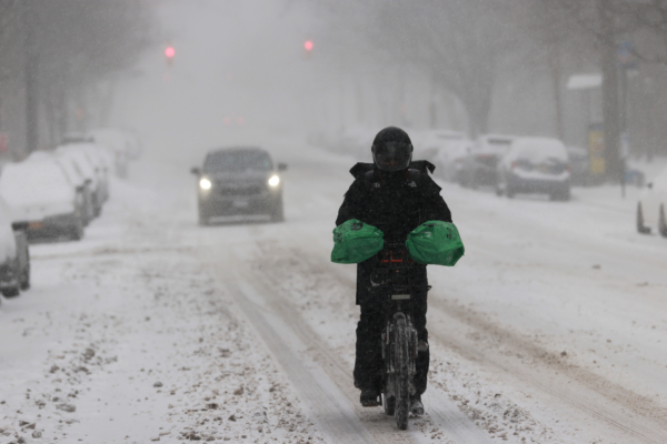
The sustained low temperatures, coupled with occasional snow showers or icy conditions, will pose greater challenges in maintaining road surfaces, railway tracks, and airport runways. Despite the passing of winter storms, icy conditions may still form on roads and sidewalks due to temperature differentials, leading to pedestrian slips and increased driving hazards.
The extremely low temperatures are expected to cause a surge in heating demands, resulting in a sharp increase in electricity and natural gas usage. While there have been no widespread power outage alerts issued yet, the burden on energy supply and heating systems will further escalate. Residents are advised to watch out for frozen pipelines and abnormal heating equipment, prioritizing the maintenance of warm indoor environments for infants, the elderly, and vulnerable individuals.
Moreover, the low temperatures may lead to frozen pipes, prompting experts to recommend leaving faucets slightly open at night to allow for dripping and reduce the risk of pipe bursting due to freezing.
Meteorological agencies and public safety units jointly urge the public to minimize non-essential outdoor activities, especially during the coldest nighttime and early morning hours. Winter driving should involve reduced speed, increased braking distances, and appropriate layers of warm clothing, hats, gloves, and waterproof boots for outdoor excursions. Monitoring the safety and physical conditions of children, elders, outdoor workers, and the homeless population is crucial during this frigid period.