
The New York City government is currently working on creating a highly confidential digital map covering all underground facilities in the city, aiming to solve the longstanding “underground maze” issue that has been troubling both the city government and contractors. Officials point out that the lack of comprehensive, centralized management of underground pipeline information has led to delays and cost overruns in multiple public projects, and even impacted emergency response efficiency.
According to Thomas Wynne, Deputy Commissioner of Infrastructure at the Department of Design and Construction (DDC), in an interview with Gothamist, the replacement project for the sewage pipeline on York Avenue serves as an example. The project was originally expected to be completed in two to three years, but due to the discovery of numerous unregistered pipelines and facilities during excavation, it has now entered its ninth year. “The biggest problem is that we keep encountering underground facilities that we didn’t know existed,” he said.
To address this issue, the city government will utilize a $10 million federal grant, led by the Mayor’s Office of Operations, to integrate information on water pipes, cables, natural gas lines, and other infrastructure. They aim to establish the first high-tech, confidential underground facility mapping platform in the United States, expected to be launched in early 2028.
Project manager Dan Steinberg emphasizes that this initiative is not only to save time and costs in construction projects but also crucial for ensuring public safety. He describes the current practice at emergency sites, where frontline personnel sometimes have to lay out multiple paper maps on the hood of a car to compare information, stating that “this outdated method carries a very high risk of errors.”
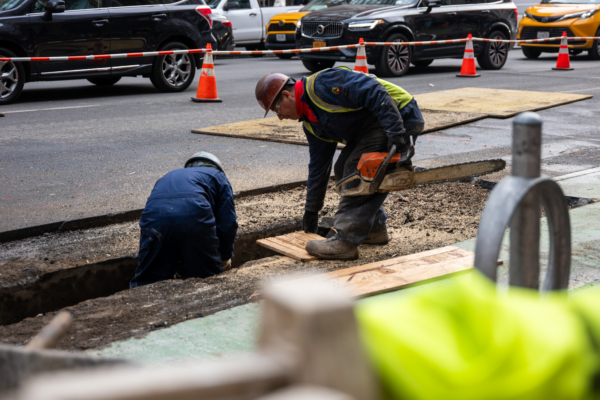
Due to the dense and intertwined network of pipelines, projects involving underground construction often force workers to “dig slowly like using a spoon,” with the potential for accidents with even a slight mistake.
Once the digital map of underground facilities is completed, project teams will be able to instantly access underground information, with the city estimating that a single project could save six months to a year of preliminary investigation time.
This concept traces back to the rescue and recovery operations following the 9/11 attacks in 2001, when information on underground facilities was fragmented, severely affecting decision-making efficiency.
Steinberg stated that New York’s plan was inspired by practices in Singapore, Tokyo, Belgium, and the UK. A similar project was launched in the UK in 2019 and began testing in mid-2025, with officials estimating an annual economic benefit of at least $535 million.
In order to prevent leakage of critical infrastructure information, the map will not be made available to the public and will only be accessible to specific levels of city officials for “necessary and time-limited” use. The system will adopt a “cut request system,” where authorized personnel can request information for specific locations, and the relevant agencies will release the data in an integrated 3D format, automatically deleting it after the designated period ends.
Various entities such as the Metropolitan Transportation Authority (MTA), telecommunications companies, Con Edison, and National Grid hold their respective underground infrastructure data. The city government acknowledges that they cannot compel businesses to hand over complete data and can only gradually progress through negotiated cooperation.
Wynne emphasizes that this is a long-term project that is an “investment for the future century,” stating that “simply starting to integrate existing data is already a quantum leap forward.”