
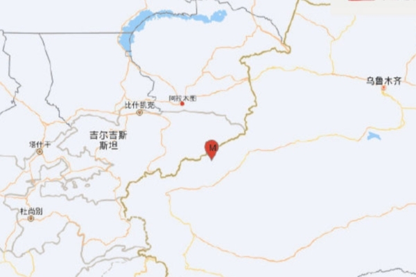
On December 4th at 15:44, a 6.0 magnitude earthquake struck Aheqi County in the Kizilsu Kirgiz Autonomous Prefecture in Xinjiang, with a depth of 10 kilometers.
According to the China Earthquake Networks Center, the epicenter of the quake was located at 41.13 degrees north latitude and 78.40 degrees east longitude. The epicenter was 21 kilometers from Aheqi County, 70 kilometers from Wushi County, 89 kilometers from Keping County, 149 kilometers from Bachu County, 154 kilometers from Wensu County, 152 kilometers from Tumxuk City, and 813 kilometers from Urumqi City.
Many netizens on social media platforms reported feeling the earthquake in areas such as Aksu, Kashi, and Yining.
The China Earthquake Networks Center’s rapid report catalog shows that within 200 kilometers around the epicenter, there have been a total of 401 earthquakes of magnitude 3 or above in the past five years. The largest earthquake was a 7.1 magnitude quake that struck Wushi County in Aksu Prefecture, Xinjiang on January 23, 2024, located 24 kilometers away from the epicenter of this recent quake.