
On Tuesday, February 24, in most parts of the northeastern United States, the weather was sunny, with millions of people recovering from a severe snowstorm and starting to return to their normal routines of going to school and work. Roads are reopening and public transportation is resuming operations.
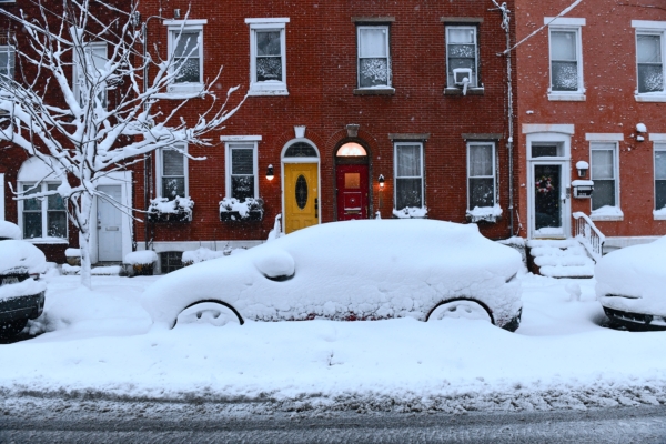
However, the powerful snowstorm that swept through the region from Sunday through Monday caused flight cancellations, transportation disruptions, and power outages, leaving record snowfall in some areas.
In New York City on Tuesday, over 900,000 students in the largest public school system in the country returned to regular classes, with many parents having to navigate through piles of snow and dodge salt trucks on their way to drop off their children.
Danielle Obloj, a parent of a fifth-grader in Brooklyn, said, “We are walking on thin ice now. Another day off would have been better, they shouldn’t have made these kids come back to school.”
Some praised the city government’s snow removal efforts. Raul Garcia, a resident, expressed, “This time was much better than the last one, commuting was easy, no problems at all. We thought walking would be terrible, but the streets are so clean.”
School districts in other areas on Long Island and suburbs of New York continued to have closures on Tuesday, while schools in Philadelphia conducted online classes on Monday and Tuesday.
On Tuesday morning, some power was restored to hundreds of thousands of households in Massachusetts, New Jersey, Delaware, and Rhode Island, who had experienced power outages.
Railway companies, including New Jersey Transit, have resumed operations. The Long Island Rail Road deployed a snow-clearing train nicknamed “Darth Vader” to remove accumulated snow.
However, Amtrak canceled some trains running between Boston and New York as well as between New York and Philadelphia.
According to meteorologists, T.F. Green International Airport in Rhode Island suspended operations on Monday due to nearly 38 inches of snowfall, breaking the record of 28.6 inches set in 1978. The airport remained closed until Tuesday morning for assessment.
FlightAware data showed that around 2,200 flights within and to/from the US were canceled on Tuesday, with most cancellations affecting airports in New York, New Jersey, and Boston.
Meteorologists stated that Monday’s snowstorm was the strongest in a decade, with some areas in the Northeast experiencing over 2 feet of snowfall.
The National Weather Service (NWS) reported that Rhode Island received over 3 feet of snow, surpassing the historic snowfall from the 1978 Northeast snowstorm.
The storm on Monday was termed a “bomb cyclone/nor’easter” by the meteorological department, referring to a phenomenon where a storm’s pressure drops significantly within 24 hours.
Despite the snow moving northwards on Tuesday, clearing up skies in parts of the Northeast, NWS forecasters warned of another storm approaching from the Great Lakes region.
The meteorological department indicated they were monitoring another storm that may bring more snow to the region later this week. Rain and snow are expected on Wednesday, with snowfall potentially reaching several inches.
Frank Pereira, a meteorologist at the University of Maryland, College Park, stated that while the upcoming storm is not expected to be as severe as the previous one, additional inches of snow in heavily impacted areas could complicate clean-up efforts.
(based on reporting from the Associated Press)