
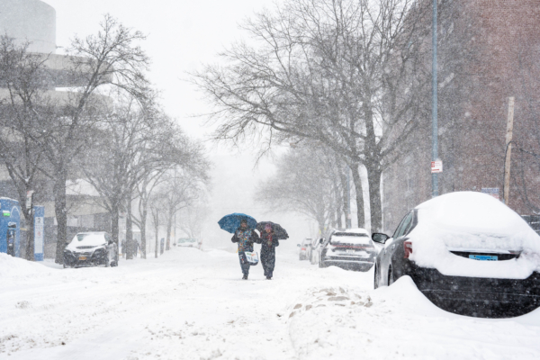
The majority of the US East Coast is still reeling from the impact of the massive winter storm from last weekend, and another powerful winter storm may be on the horizon.
According to the weather forecast website Weather.com, an upcoming storm this weekend could potentially create a “bomb cyclone,” bringing heavy snow, strong winds, and possible coastal flooding from South Carolina, North Carolina to the New England region. Some areas are still recovering from the ice and snowstorm last weekend.
Carl Erickson, the Director of Forecast Operations at AccuWeather, a private media company providing commercial weather forecast services, stated in an email to USA TODAY that the risk of coastal storm rapid intensification this weekend is increasing. Communities along the East Coast are still digging out and cleaning up from the snowstorm last weekend, and these areas may face another round of snowfall.
Weather.com meteorologist Jonathan Erdman mentioned in an online forecast that the storm is likely to bring significant snowfall to two main areas:
1. From southern Virginia to northern North Carolina, possibly including parts of South Carolina.
2. Eastern parts of New England, possibly including areas that saw over 20 inches of snow from last weekend’s winter storm.
The National Weather Service (NWS) stated, “The current consensus is that significant snow is possible from eastern North Carolina and the mid-Atlantic coast to southern and eastern coastal New England.”
The NWS further warned of the potential storm intensity supporting threats of strong winds, high waves, and coastal flooding.
Additionally, the NWS pointed out that the gradually strengthening onshore winds along the mid-Atlantic coast could lead to several rounds of coastal flooding and dangerous waves this weekend.
As of the morning of January 28, data from the National Oceanic and Atmospheric Administration (NOAA) Weather Prediction Center showed a 20% chance of extreme impacts in eastern North Carolina and parts of eastern Virginia, with a smaller 5% to 10% chance for the more extensive coastal regions stretching from coastal North Carolina northward.
Areas most likely to experience moderate impacts exceed 60%, extending from central South Carolina to eastern North Carolina, southeastern Virginia, Delaware, and coastal areas of Maryland.
A “significant impact” implies a considerable disruption to daily life, including hazardous conditions, widespread facility closures, and service interruptions.
The upcoming storm is expected to become a “bomb cyclone,” essentially a winter hurricane.
A bomb cyclone is a rapidly intensifying extratropical cyclone formed by a sharp drop in atmospheric pressure. It is highly intense and results from the clash of cold and warm moist air masses, leading to a rapid decrease in atmospheric pressure within 24 hours, with powerful explosive and destructive capabilities, often accompanied by blizzards, freezing rain, floods, landslides, and other natural disasters.
While bomb cyclones may share similarities with hurricanes at times, it is essential to note that they are not the same. These two storms differ in their significance.
The NOAA Weather Prediction Center also forecasted “near-hurricane-force wind gusts” expected this weekend.
It is crucial to be cautious, as any heavy snow and strong winds will compound the effects of last weekend’s devastating winter storm. Many communities are still grappling with persistent cold conditions, working to restore power and clear snow.
In conclusion, if you reside in the region spanning from South Carolina to North Carolina and up to the Northeastern US, please stay tuned to the latest weather forecasts and prepare for the storm now.
(This article was referenced from USA TODAY’s report)