
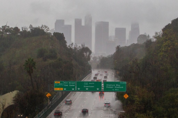
After experiencing unusually warm and dry weather in January and early February, the western United States is forecasted to transition into a cooler and more humid weather pattern starting this week. Southern California is expected to see a decrease in daytime high temperatures by 10 to 15 degrees Fahrenheit starting from Tuesday, with the possibility of rain over the weekend.
According to the California weather website “Weather West,” snow levels in most mountainous areas of the western U.S. have reached historically low levels in February. The precipitation situation varies across the region, with central and southern California experiencing record-breaking or near-record rainfall at the beginning of winter, while parts of western inland areas in Utah and Colorado have been facing record drought conditions.
At the same time, much of the eastern U.S. has been enduring some of the coldest periods in decades, along with destructive and even deadly snowstorms. In the coming days, the overall weather pattern across the continental United States is expected to undergo a significant reversal that may last at least one to two weeks.
Starting from Tuesday, a moderately intense but “energetic” low-pressure system is set to pass through San Francisco, bringing the first round of rain, strong winds, and high-elevation snow to central California. Temperatures in most areas of Southern California are expected to drop, with snowfall predicted in the western mountain regions in the next two weeks. However, there remains uncertainty regarding the weather towards the end of February.
The coastal waters off California have been experiencing an intrusion of ocean heatwaves in recent months, with water temperatures in most areas running 3 to 5 degrees Fahrenheit above average, and even higher in some localized areas—posing significant anomalies for marine conditions.
Currently, a widespread and intensifying ocean heatwave is affecting the entire Pacific Coast of North America, stretching from Southern California to Alaska. These abnormal ocean heatwaves may lead to increased rainfall or thunderstorm activity along coastal regions, with a potential formation of a cold air mass in western Canada by mid-February, although its movement direction remains uncertain.
According to the National Weather Service, temperatures in Southern California are expected to start declining from Tuesday, then rebound over the weekend before dropping again, with rain expected from Sunday onwards. In Los Angeles, the temperature is forecasted to drop from a high of around 80 degrees Fahrenheit (about 26.7 degrees Celsius) on Monday to approximately 65 degrees (around 18.3 degrees Celsius).
Precipitation estimates for the Los Angeles area suggest less than 1/10 of an inch of rainfall; coastal areas in Orange and San Bernardino counties may receive between 1/3 to 1/2 inch of rain, with higher amounts expected in the San Bernardino Mountains ranging from 1/2 to 1 inch; the rainfall is anticipated to decrease gradually from north to south, with lower amounts of 1/10 to 1/4 inch expected in the southern part of San Diego County.