
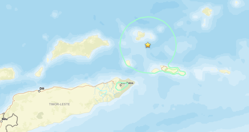
A strong earthquake measuring 6.8 on the Richter scale struck on Saturday, November 21, northeast of Lospalos, East Timor, approximately 105 kilometers away. This information was confirmed by the United States Geological Survey (USGS), which indicated that the quake had a depth of 143.4 kilometers (89 miles).
Another assessment from the German Research Centre for Geosciences (GFZ) determined that the earthquake occurred in the Banda Sea, roughly 226 kilometers (140 miles) northeast of the capital city, Dili. According to GFZ, this quake had a slightly shallower depth of 117 kilometers.
As of now, there have been no verified reports of casualties or significant damage stemming from the earthquake. The USGS’s Prompt Assessment of Global Earthquakes for Response (PAGER) has categorized the quake with a “green” alert, indicating that the likelihood of serious injuries and property damage is low.
However, the potential extent of destruction remains a concern for local residents. Most buildings in the region are particularly vulnerable to seismic activity due to their construction styles. While there are some structures designed to withstand earthquakes, many buildings consist of unreinforced masonry with concrete slabs or prefabricated concrete frames and walls, making them susceptible to seismic vibrations.
Historically, earthquakes in this area have triggered secondary disasters, such as landslides, which have exacerbated both injuries and property loss. The risk of such incidents adds to the gravity of the situation and necessitates careful monitoring of any aftershocks or related geological events.
According to reports from the Australian Broadcasting Corporation (ABC), the seismic effects of this earthquake were felt as far away as northern Australia. Residents in Darwin, the capital of the Northern Territory, and surrounding areas reported feeling the vibrations. Geoscience Australia, the national agency responsible for geological science, has noted receiving over 1,600 reports regarding the tremors from concerned citizens.
East Timor, located southeast of the island of Java in Indonesia, faces the Timor Sea to the south and is approximately 400 kilometers from northern Australia. The proximity to tectonic plate boundaries makes the region particularly prone to earthquakes, raising ongoing concerns about preparedness and resilience in the face of natural disasters.
As the situation develops, it will be crucial for local authorities and international agencies to remain vigilant and ready to assist the population in mitigating any future impacts. Community awareness and infrastructure improvements will play a key role in enhancing the region’s disaster response capabilities.