
Recent heavy rains have caused disasters in southern China, while the upper reaches of the Ussuri River in the northern region are experiencing the largest flood since actual measurement data began.
According to the website of the Chinese Ministry of Water Resources on June 29th, since June 20th, the Ussuri River basin has accumulated 91 millimeters of rainfall, which is 2.6 times more than the same period in a normal year, ranking first for the same period since 1961.
As a result, 24 rivers including the main stream from Tiger’s Head (Hulin City) to Dong’an Town (Raohe County), and tributaries such as Muling River, Naoli River, Peide River, and Neiqixing River in the Ussuri River basin have experienced floods exceeding the warning level. Among them, the main stream of the Ussuri River from Tiger’s Head to Raohe (Raohe County) and its tributaries, Muling River and Naoli River, have experienced floods exceeding the safety level.
The upper reaches of the Ussuri River have seen the largest flood since actual measurement data began. The flood peak water level at the Tiger’s Head hydrological station on June 29th at 4 a.m. reached 57.99 meters, exceeding the safety level by 0.90 meters, making it the highest water level recorded since 1951.
By 8 a.m. on June 29th, the water level in the main stream of the Ussuri River from Tiger’s Head to Dong’an Town exceeded the warning level by 0.74 to 1.94 meters, with the section from Tiger’s Head to Raohe exceeding the safety level by 0.39 to 0.89 meters. It is expected that from June 29th to July 5th, there will be continuous light to moderate rainfall in the Ussuri River basin. Due to rainfall and inflow from upstream, the Raohe section of the main stream of the Ussuri River is expected to reach a flood peak water level around 0.80 meters above the safety level around July 2nd, while the Dong’an Town section is expected to reach a flood peak water level around 1.00 meters above the warning level around July 4th, and the Haiqing (Fuyuan City) section is expected to reach a flood peak water level around the safety level around July 5th.
As of 6 a.m. on June 30th, the China Meteorological Administration has continued to issue a red alert for heavy rain: from 8 a.m. on June 28th to 5 a.m. on June 30th, parts of Jiangsu, Anhui, Henan, Hubei, Hunan, Guizhou, Yunnan, and Guangxi have experienced heavy to severe rain, with localized severe rain in places like Anhui and Hubei accompanied by short-term heavy precipitation.
It is predicted that from 8 a.m. on June 30th to 8 a.m. on July 1st, there will be heavy rain in parts of Jiangsu, Anhui, Jiangxi, Zhejiang, Shanghai, Hunan, Guangxi, and Guizhou, with severe rain in certain areas of Anhui, Jiangxi, Zhejiang, Hunan, Guizhou, and Guangxi, and localized severe rain in Hunan and other areas.
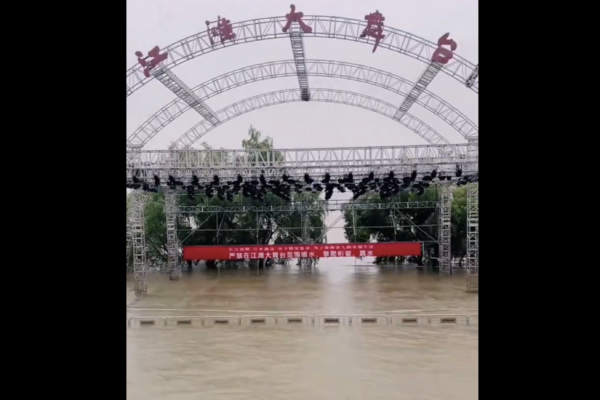
In addition, on June 28th, the Yangtze River Water Resources Commission of the Chinese Ministry of Water Resources reported that due to continuous rainfall, major floods have occurred in several tributaries including Dongting Lake and Poyang Lake in the middle and lower reaches of the Yangtze River. Water levels in these areas and the main stream have risen rapidly.
The report stated that at 2 p.m. on the 28th, the water level at the Jiujiang station on the main stream of the middle and lower reaches of the Yangtze River rose to 20.00 meters (the flood warning level is 20.00 meters), meeting the flood criteria.
By noon on the same day, real-time water data showed that the water level at the Hukou station on the main stream of the Yangtze River was 19.52 meters, exceeding the warning level by 0.02 meters. This was also the first time this flood season that the water level of the main stream of the Yangtze River had exceeded the warning level.