
On Tuesday, December 17th, local time, a powerful earthquake with a magnitude of 7.4 struck the Pacific island nation of Vanuatu, potentially triggering dangerous tsunamis.
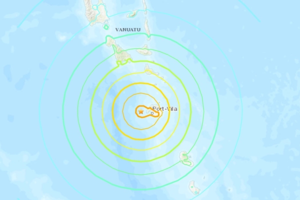
The United States Geological Survey reported that a 7.4 magnitude earthquake hit Port-Vila, Vanuatu, with a depth of 10 kilometers (6.21 miles).
Following the earthquake, the United States tsunami warning system issued tsunami alerts.
The Pacific Tsunami Warning Center predicted that coastal areas of Vanuatu could experience tsunamis ranging from 0.3 meters to 1 meter above normal tide levels. Waves of less than 0.3 meters could impact coasts of Fiji, Tuvalu, and the Solomon Islands among others.
According to Reuters, videos shared on social media showed windows of a foreign embassy building in Vanuatu’s capital, Port-Vila, being bent and concrete pillars collapsing.
Vanuatu is located in the western South Pacific, part of the Melanesian islands. It is situated 1900 kilometers east of Brisbane, Australia, 800 kilometers west of Fiji, 230 kilometers north of New Caledonia, and 170 kilometers south of the Solomon Islands, with its capital at Port-Vila.