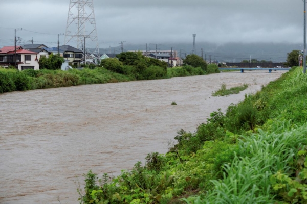
Typhoon “Shanshan”, which was considered to be approaching the “strongest level in recent years,” made landfall in Japan before sweeping through the Shikoku region today (August 31). It then proceeded eastward in the sea near the Kii Peninsula. As of late evening local time, it has caused 6 deaths, 125 injuries, and over 1000 houses flooded or damaged.
According to the “Nihon Keizai Shimbun,” Typhoon “Shanshan” is forecasted to move north across Honshu tomorrow (September 1) and may transform into a tropical depression by September 2. Between now and tomorrow morning, there is a possibility of localized heavy rains in the Kanto-Koshin, Tokai regions with a line-shaped convective system (known in Japan as a line-shaped rain band, where cumulonimbus clouds are arranged in a line spanning 50 to 300 kilometers), prompting the Japan Meteorological Agency to advise the public to be on guard against heavy rains.
The Fire and Disaster Management Agency of Japan stated that as of this afternoon, the typhoon has caused 6 deaths in 4 prefectures. In 14 prefectures, including Miyazaki, Kagoshima, and Fukuoka, 125 people have been injured. Across the country, a total of 1080 houses in Miyazaki, Oita, Shizuoka, and other prefectures have been flooded or partially damaged by the typhoon or strong winds.
This afternoon in Mie Prefecture, a line-shaped convective system brought heavy rains to certain areas, posing a risk of river flooding. The Mie Prefectural Government issued an emergency order for residents in some areas to ensure their safety. Additionally, in Gifu Prefecture, river flooding occurred, resulting in severe flooding in residential areas of Ogaki City and Ikeda Town, leading the Gifu Prefectural Government to declare the application of the Disaster Relief Act.
The impact of Typhoon “Shanshan” on transportation continues to be felt. JR Tokai announced today that the Tokaido Shinkansen between Tokyo and Nagoya will temporarily stop operation starting tomorrow morning. Specifically, between Mishima and Nagoya, a preventive suspension has been in effect since August 30-31. The feasibility of travel between Tokyo and Mishima will be announced tomorrow morning. Reduction in services will start from the first train between Nagoya and Shin-Osaka.
The Japan Meteorological Agency stated that even if Typhoon “Shanshan” weakens into a tropical depression, warm and humid air from the peripheral Pacific high-pressure system may cause heavy rains in eastern and northern Japan before September 3.
Due to the slow speed of Typhoon “Shanshan,” record-breaking heavy rains have fallen between western and eastern Japan. From August 27 to 31, precipitation exceeded 900 millimeters in Shingawa City, Miyazaki Prefecture, surpassing the total rainfall for the entire month of August in previous years. Ito City in Shizuoka Prefecture received over 700 millimeters, and Oodai Town in Mie Prefecture received over 670 millimeters of rainfall.
The Japan Meteorological Agency predicts that the 24-hour rainfall by tomorrow 6 p.m. will be 400 millimeters in the Tokai region, 300 millimeters in the Kanto-Koshin region, and 200 millimeters in the Kinki region. For the following 24-hour period until 6 p.m. on September 2, the Tokai and Kinki regions are forecasted to receive 200 millimeters of rainfall, and the Kanto-Koshin region, 120 millimeters.
As of 6 p.m. today, Typhoon “Shanshan” was moving eastward at a speed of 15 kilometers per hour near Cape Nanki, Wakayama. The central pressure was 996 hPa, with maximum sustained winds of 18 meters per second and gusts up to 25 meters per second.
(Source: Central News Agency)

