
Taiwanese Meteorological experts announced that Typhoon Fanxigao has weakened to a tropical depression this morning. From today until the 27th, the influence of Typhoon Fanxigao, along with the outer periphery of Typhoon Zhujiecao and the seasonal wind circulation, will bring rain to the northern to central regions of Taiwan, accompanied by heavy rain and strong gusts. In the southern regions, there is also a chance of localized showers or thunderstorms.
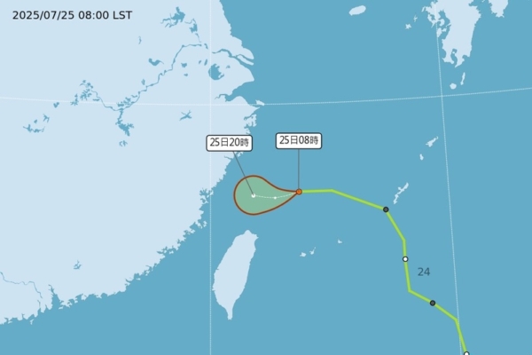
According to the Central Weather Bureau of Taiwan, as of 8 a.m. today, Typhoon Fanxigao has weakened to a tropical depression, moving westward at a speed of 15 kilometers per hour from 290 kilometers northeast of Taipei over the sea. Currently, there are two typhoons over the waters, namely Typhoon Zhujiecao and Kerosa.
Wu Derong, an associate professor in the Department of Atmospheric Sciences at National Central University of Taiwan, stated in a column for the Meteorological Applications Promotion Fund’s “Sky Classroom” today that the latest European model simulation indicates that from today until the 27th, the influence of Typhoon Fanxigao, Typhoon Zhujiecao, and the seasonal wind circulation will bring rain to the northern to central regions, accompanied by heavy rain and strong gusts. In the southern regions, there is also a probability of localized showers or thunderstorms.
Wu added that the latest models suggest that from the 28th to the 31st, affected by the seasonal wind circulation, the atmosphere will be unstable, leading to rainy conditions in the central and southern regions, with localized showers turning into thunderstorms. There is also a probability of localized “severe weather” (lightning, strong winds, and intense rainfall) which could be hazardous and should be taken note of. The eastern half of the windward side will be less affected, with occasional brief rainfall and hot weather when there’s no rain.
Wu Derong went on to say that according to the latest “Path Potential Forecast Map” from the Meteorological Bureau as of 2 a.m. on the 25th, “Typhoon Fanxigao” is located west of the Ryukyu Islands, moving towards the northern sea area with a loose structure. Another typhoon, Zhujiecao, is moving northeastward and will pass through Luzon Island, gradually weakening.
He pointed out that both typhoons are influenced by the seasonal wind circulation, and there is also some “Fujiwara Effect” (a dance of two typhoons) between them, showing a path of counter-clockwise interaction. However, both of them may weaken to tropical depressions at any time. The latest European model ensemble path simulation shows that Typhoon Kerosa is located north of Guam, steadily intensifying. The ensemble model paths mainly lean northward and do not participate in the “dance,” posing no impact on Taiwan.