
The Taiwan Central Weather Bureau announced today (November 15) that Typhoon Usagi continues to weaken. As of 5 a.m. this morning, it has downgraded to a moderate typhoon. It is expected to continue weakening with a shrinking wind radius trend. The bureau may lift the sea and land warnings as soon as the 16th, while continuing to monitor the typhoon’s movement.
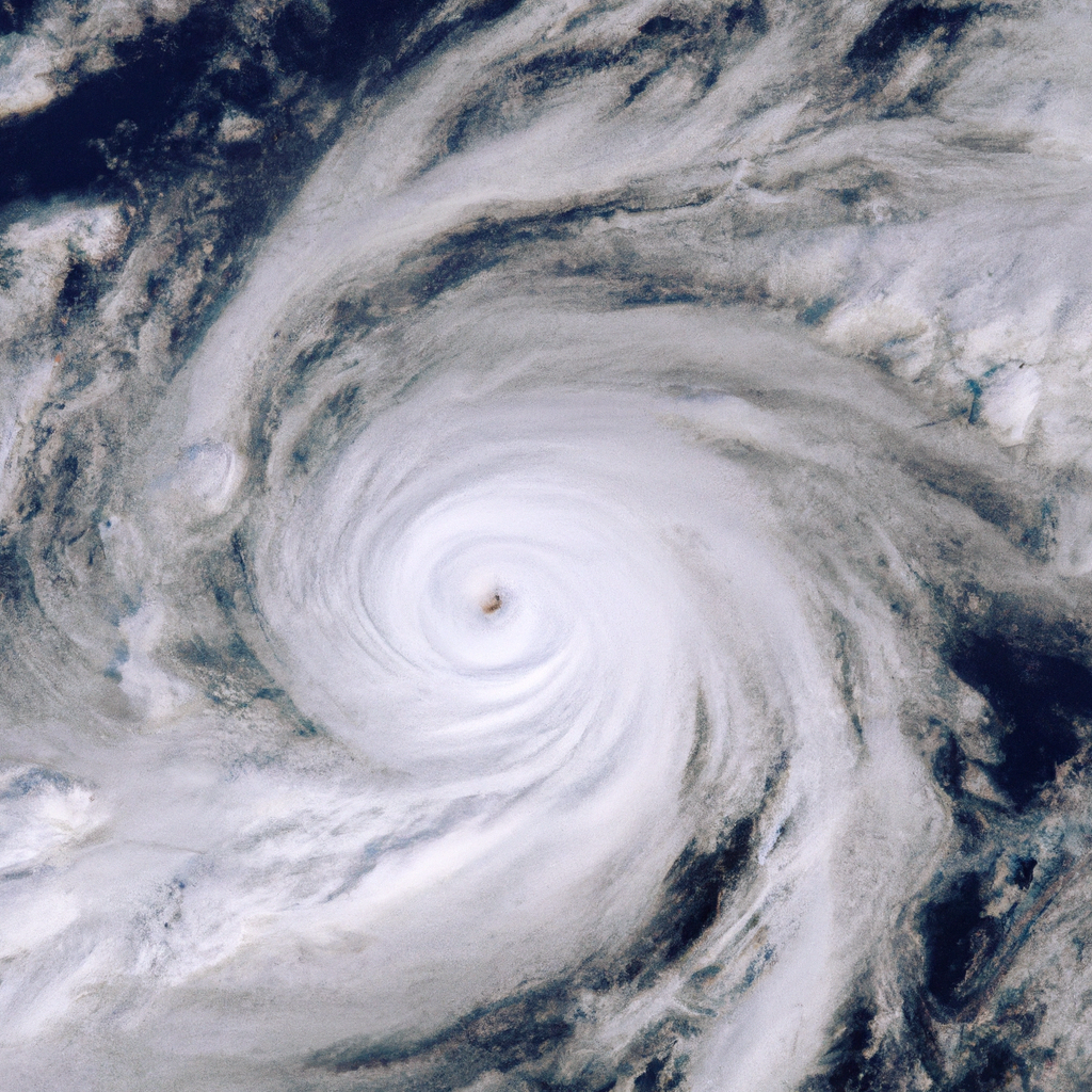
The Central Weather Bureau reported that at 2 a.m. this morning, the center of Typhoon Usagi was located at 19.6 degrees north latitude and 120.7 degrees east longitude, moving northwest at a speed of 17 kilometers per hour. The central pressure is 965 hPa, with maximum sustained winds near the center of 35 meters per second and maximum gusts of 45 meters per second. The radius of strong winds (Beaufort scale 7) reaches 150 kilometers, and the radius of typhoon force winds (Beaufort scale 10) is 50 kilometers (50 kilometers on the northwest side, 50 kilometers on the northeast side, 40 kilometers on the southwest side, and 50 kilometers on the southeast side).
The Central Weather Bureau issued a statement on Facebook, announcing the current position of Typhoon Usagi (internationally named USAGI) at 9:00 a.m., located at 20.4 degrees north latitude and 120.0 degrees east longitude, about 190 kilometers south-southwest of Eluanbi, moving north-northeast at a speed of 11 to 8 kilometers per hour.
Regarding the current movement of the typhoon, the Central Weather Bureau stated that based on the latest data, Typhoon Usagi, currently located in the waters south-southwest of Eluanbi, is moving north-northeast. Its wind circle has entered the waters near southern Taiwan, posing a threat to Kaohsiung, Pingtung, Taitung, and the Hengchun Peninsula. It is expected that the typhoon will continue to weaken with a shrinking wind radius trend.
Land warning areas: Kaohsiung, Pingtung, Taitung, and the Hengchun Peninsula should be on high alert. Sea warning areas: the southern Taiwan Strait, southeastern Taiwan waters, Bashi Channel, and the waters near Dongsha Island, ships should exercise caution.
The Central Weather Bureau stated that waves in the southeast waters of Taiwan, the southern Taiwan Strait, and the Bashi Channel will gradually increase to around 3 meters, with waves reaching 4 to 6 meters near the Hengchun Peninsula. There is a probability of long swells occurring along the eastern and southwestern coasts, the Hengchun Peninsula, Penghu, Orchid Island, Green Island.
Special strong wind forecast for land: Starting from this morning along Keelung’s north coast, the Hengchun Peninsula, and Matsu, and from the afternoon along the open coastal areas of Pingtung and Orchid Island, Green Island, Penghu, strong gusts of 8 to 9 Beaufort scale are expected. Later in the evening, the Hengchun Peninsula will experience strong gusts of 9 to 10 Beaufort scale.
At a press conference about the Typhoon Usagi warning at 8:40 a.m., the appointed technical officer of the Central Weather Bureau, Wu Wanhua, stated that it is estimated that the typhoon’s wind circle will make landfall in the south later in the evening. As for the intensity of the typhoon, Usagi has been weakening since entering the Bashi Channel on the 14th, and as of 5 a.m. today, it has already downgraded to a moderate typhoon. As it continues to move northward, it is expected that the intensity will further weaken, possibly becoming a tropical depression by the latter half of tomorrow, either making landfall in Taiwan or dissipating over the ocean.
When asked about the possibility of lifting the sea and land warnings, Wu Wanhua mentioned that the typhoon will likely only weaken to a tropical depression as it nears Taiwan or after passing over Taiwan’s airspace, possibly by the 16th or later in the day. However, if the typhoon does not weaken to a tropical depression and remains over Taiwan’s airspace, there is a possibility it might still be present on the 17th morning. Therefore, the situation of Usagi’s weakening will be continuously monitored by the bureau.