
Tropical storm “Barbara” has intensified into a hurricane, becoming the first hurricane of the Eastern Pacific hurricane season this year.
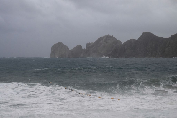
According to the National Hurricane Center in Miami, Florida, the storm system is projected to generate swells that will impact coastal areas of southwestern Mexico in the coming days. These swells could potentially create life-threatening waves and rip currents along the coastline.
As of Monday, “Barbara” is located approximately 155 miles (245 kilometers) southwest of Manzanillo, Mexico, with maximum sustained winds of 75 miles per hour (120 kilometers per hour). The storm’s center is moving towards the northwest at a speed of 10 miles per hour (17 kilometers per hour).
No coastal warnings or watches have been issued as of Monday morning. However, it is expected that the storm will bring heavy rainfall to coastal areas of Guerrero, Michoacan, Colima, and Jalisco states in Mexico, possibly leading to localized flooding.
The National Hurricane Center warns that the swells generated by “Barbara” could result in life-threatening large waves and rip currents along the southwestern coast of Mexico, accompanied by gusty winds.
Meanwhile, tropical storm “Cosme” has also slightly strengthened on Monday, although it remains far from the Mexican coastline, positioned approximately 630 miles (1015 kilometers) south-southwest of Baja California in northwestern Mexico.
As of 2 a.m. Monday local time, “Barbara” has sustained winds of 50 miles per hour (80 kilometers per hour), moving towards the west-northwest at 9 miles per hour (14 kilometers per hour). It is projected that “Cosme” will approach hurricane strength on Monday, then turn northeast and accelerate its movement from Tuesday to Wednesday.
(This article referenced reports from the Associated Press)