
Taiwan is currently facing the impact of two typhoons, Fanisgao and Chu Jie Cao. Meteorologists say that starting today (24th), there are two typhoons affecting the periphery of Taiwan. Due to the influence of Typhoon Fanisgao and the seasonal monsoon circulation, there will be significant rainfall in the northern and northeastern regions today.
Following the formation of Typhoon Fanisgao on the 23rd, the Central Weather Bureau in Taiwan announced that Typhoon Chu Jie Cao, the 8th typhoon of the year, was formed on the western sea area of the Philippines at 8 p.m. on the 23rd. It is expected to weaken after passing the northern side of the Philippines, bringing moisture to the southeastern region of Taiwan on the 25th and 26th.
Associate Professor Wu Derong from the Department of Atmospheric Sciences at National Central University in Taiwan stated in the “Heavenly Machine Classroom” column of the Meteorological Application Promotion Foundation on the 24th that the latest European model simulation (ECMWF) from 8 p.m. on the 23rd shows that today, the impact of Typhoon Fanisgao and the seasonal monsoon circulation will bring significant rainfall to the northern and northeastern regions with strong gusts. There is a chance of local showers or thunderstorms in the central and southern regions in the afternoon.
According to Wu Derong, the latest model simulation shows that from the 25th to the 27th, the periphery of Typhoon Fanisgao and Chu Jie Cao will be influenced by the seasonal monsoon circulation. Rain is expected in the central to northern regions with heavier rainfall and strong gusts, and there is a chance of local showers or thunderstorms in the southern region as well. From the 28th to the 30th, under the influence of seasonal monsoon circulation, the atmosphere will be unstable with a chance of local showers across different areas, vigorous convective development in the afternoon, and attention should be paid to the occurrence of localized “severe weather” (lightning, strong winds, and sudden heavy rainfall) during rainless periods, with hot and humid weather conditions.
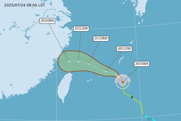
Wu Derong mentioned that the latest “Path Potential Prediction Chart” from the Central Weather Bureau at 2 a.m. on the 24th shows that the tropical storm Fanisgao will pass through the eastern sea of Taiwan and enter the northern sea area with a loose structure. Another tropical storm, Chu Jie Cao, will turn northeast of the northwest of Luzon before gradually weakening while passing through Luzon. Both typhoons are guided by the seasonal monsoon circulation, and there is also some “Fujiwhara effect” between them, presenting a counterclockwise intertwined path.
He further explained that the latest European model simulation predicts that the third tropical system in the set will be located in the sea area north of Guam, with a stronger intensity development, but it will not be involved in the interaction with the other two typhoons, acting as an observer. The majority of the simulation paths tend to be northward, having no direct impact on Taiwan.