
India recently announced a total transmission and hydropower plan worth a staggering $77 billion, with the aim of completing the 76-gigawatt (GW) Brahmaputra River basin transmission project originating from Tibet by 2047. Analysts believe that this move is India’s strong response and strategic countermeasure to China’s accelerated construction of the “world’s largest hydroelectric dam” project in the upstream of Tibet, aiming to advance its geopolitical control.
The Brahmaputra River originates from the Angsi Glacier in Tibet, China, with the Yarlung Tsangpo River in Tibet acting as its upper course. It flows through India and Bangladesh before emptying into the Bay of Bengal, serving as a lifeline river for the South Asian region.
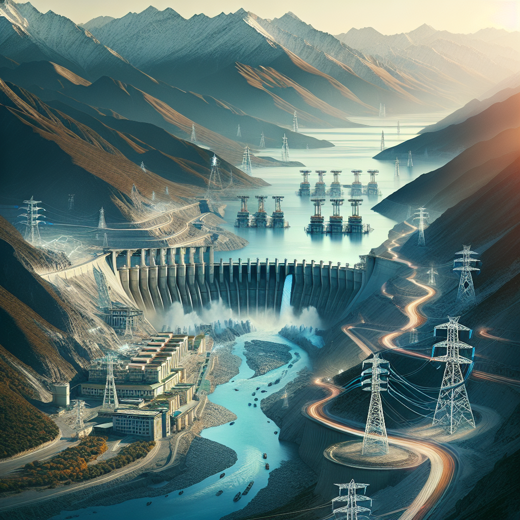
The Central Electricity Authority (CEA) of India revealed in a report on October 13 that the basin holds over 80% of India’s untapped hydroelectric potential, with the Arunachal Pradesh region bordering China accounting for 52.2 GW, more than double the generating capacity of the Three Gorges Dam at 22.5 GW.
The report outlined a comprehensive plan encompassing 12 sub-basins in the northeastern region, with a total of 208 large-scale hydropower projects and a potential electricity capacity of 64.9 GW, including an additional 11.1 GW pumped storage hydroelectric plant. The plan is set to be implemented in two phases: an investment of ₹1.91 trillion (approximately $21.7 billion) by 2035 in the first phase and an additional ₹4.52 trillion (about $51.35 billion) by 2047 in the second phase.
The CEA stated that the project not only supports India’s goal of achieving 500 GW of non-fossil fuel energy generation by 2030 and achieving net-zero emissions by 2070 but is also a crucial project to “ensure national energy and water resource sovereignty.”
Previously, on July 19, Chinese Premier Li Keqiang presided over the groundbreaking ceremony for the “Motuo Hydropower Station” on the downstream of the Yarlung Tsangpo River in Linzhi, Tibet, officially kicking off the project.
According to Xinhua News Agency, the project’s total investment amounts to 1.2 trillion RMB (about $170 billion), with a planned generating capacity ranging from 60 GW to 81 GW, equivalent to the scale of three Three Gorges Dams.
Beijing claims that the project will “provide clean energy and benefit people’s livelihoods,” supplying electricity to 300 million people. However, there are widespread doubts about its true intentions.
Internal analysis documents from the Indian government obtained by Reuters on August 25 indicated that upon completion of the Chinese dam, diverting water in the dry season could reduce water flow to India by up to 85%. Analysts pointed out that this would grant China the ability to “control the lifeline of South Asia” by potentially causing political and economic threats to India and Bangladesh through water diversion or sudden flooding.
In response to this risk, India has expedited the construction of the Upper Siang Dam, with a reservoir capacity of 14 billion cubic meters (14 BCM), allowing controlled water releases during dry seasons to stabilize the water supply and absorb sudden floods from upstream.
Indian Prime Minister Narendra Modi convened an emergency high-level meeting in July, urging to accelerate progress and prevent being “choked by the upstream.”
Water resources expert Wang Weiluo in Germany explained to the Epoch Times that India’s $77 billion plan is only an investment in transmission lines, and the actual funding for building over 200 large-scale hydropower stations could be five to ten times that amount.
He pointed out that India’s plan “clearly targets the construction of dams by China downstream of the Yarlung Tsangpo River.”
Wang mentioned that the Siang River project in India, a tributary of the Brahmaputra River, is located not far from where the river exits from Tibet in Motuo County. The backwater effect of this project would affect the safety of China’s downstream Motuo Dam site.
He stated that the Chinese government has long opposed India’s construction of this dam, and “now that India has shown determination to complete the project, it is a clear strategic declaration.”
Wang further noted that China has long marked Arunachal Pradesh in India (the “Southern Tibet region”) as its territory on maps, while the internationally recognized border—the McMahon Line—clearly shows the region belonging to India.
“The Chinese hydroelectric project planning is based on their version of the border, carrying obvious political provocation,” he warned.
He cautioned, “The last-level power station of the Yarlung Tsangpo River downstream is less than 20 kilometers from Arunachal Pradesh, the border region of the two countries. If measured by the McMahon Line, it is even less than 10 kilometers.” “Such a position is highly sensitive to military security,” he stressed.
Wang further criticized that China “might try to provoke border conflicts again under the guise of building the world’s largest hydroelectric station, preparing to regain the so-called ‘Southern Tibet region’.”
Dr. Hong Mingde, Assistant Research Fellow at the Taiwan Institute for National Defense and Security Studies, told the Epoch Times that the Brahmaputra River spans China, India, and Bangladesh, with the “control of water resources resting in the hands of China upstream,” and India’s announcement of constructing dams at this moment is “mainly to strengthen its own regional influence.”
He bluntly stated that China claims to use techniques like “bypassing bends and tunneling water diversion” to reduce surface interference, but “it is a cover-up rhetoric; the essence is controlling water resources of downstream countries.”
Hong cited a 2020 research report by the Australian Lowy Institute, warning that “China’s control over the rivers of the Tibetan Plateau actually grants it coercive power over the Indian economy.”
He warned that China’s water and hydroelectric strategy has a dual nature of “geopolitical expansion and economic deterrence,” and if a large amount of water is being diverted or discharged upstream, it would trap India and Bangladesh in a “passive dependence on water diplomacy.”
He emphasized that this water resource competition has surpassed the engineering level, becoming a regional power redistribution game.
The US-based Yale Environment 360 published an investigative report in May highlighting the potential devastating impact of China’s “Motuo Hydropower Station” mega-project on the “Asian Grand Canyon”—the Yarlung Tsangpo River Grand Canyon—which is three times deeper than the Grand Canyon in the US and one of the world’s most valuable biodiversity hotspots, housing Asia’s oldest forests and habitats for rare feline species.
The report pointed out that Tibet is known as the “Water Tower of Asia,” where its vast glaciers nurture main rivers relied upon by ten countries and over 1.3 billion people, providing drinking water, irrigation, and hydroelectric power sources. The scarcity of water resources in the South Asian region is intensifying regional tensions.
As the world’s largest hydropower nation, China has fully exploited the Yellow River, Yangtze River, as well as the Lancang River (flows into the Mekong River), Jinsha River (flows into the Irrawaddy River), and Nu River (flows into the Salween River). Now, it has set its sights on the Yarlung Tsangpo River and Brahmaputra River.
China completed its first dam on the main stem of the river—the Zangmu Hydropower Station at an altitude of about 3,200 meters in 2014. The sharp drop in the Yarlung Tsangpo River Grand Canyon has long been seen as one of the locations with the most significant hydroelectric potential globally. China announced the commencement of the project in December 2024 and officially started the work in July this year.
The planned mega-dam hydroelectric project to be built in Motuo County, Tibet by China will have a generating capacity nearly three times that of the Three Gorges Dam, making it the world’s largest single infrastructure project. The site is located only about 480 kilometers from the epicenter of the Assam–Tibet quake, with a magnitude of 8.6 on the Richter scale in 1950, making it the most powerful inland earthquake in history.
“Turning water resources into weapons is a risky strategy that could backfire on itself,” warned Mehebub Sahana, a scholar at the University of Manchester in the UK.
The report highlighted that the dam project site is located at the intersection of two major tectonic plates, one of the most seismically active regions globally. Scholars speculate that the most significant concern for Chinese planners would be a major earthquake leading to dam collapse.