
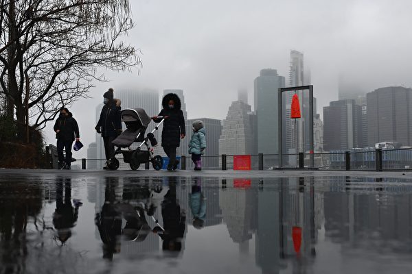
A fast-moving storm is set to bring a wintry mix of rain and snow to New York starting on Tuesday, December 2nd. Although accumulation of snow may not be significant, temperatures are expected to drop below freezing from Thursday night onwards, urging residents to take precautions to stay warm.
On Monday, December 1st, Richard Otto, a forecaster at the American Weather Prediction Center, stated that a winter storm is bringing mixed weather to the central and southern regions of the United States, with heavy snow expected in New England while New York State and the Washington D.C. area will see a mix of rain and snow. Kansas has already experienced heavy snow, while Arkansas is facing freezing conditions.
The heaviest snowfall is anticipated in northern New York State and parts of Massachusetts, extending all the way to Maine. Accumulation could reach up to 30 centimeters (12 inches) from Monday night to early Tuesday morning.
Additionally, snow is expected from central Pennsylvania inland to central New England.
Despite the early snowfall this year, there are precedents for it, according to John Feerick, a senior meteorologist at AccuWeather. He mentioned that the New York City area should remain dry during Monday night through Tuesday morning, with rain expected to start between 8 to 10 AM on Tuesday.
During the initial stages of the storm, there may be some light wet snow but no significant accumulations are foreseen, with temperatures likely to stay above freezing. By midday Tuesday, Staten Island, New York City, and coastal areas will transition to rain.
Meteorologists predict the rainfall will rapidly diminish by Tuesday evening.
Feerick added that areas with more cold air, like northern and western parts of New York, will experience longer durations of snowfall. Some regions, such as northwestern New Jersey through the Hudson Valley, may see 1 to 3 inches of snow.
Areas farther away from the city are expected to receive greater snowfall. Moving northwest, places like the Pocono and Catskill Mountains all the way to Albany could experience the most significant accumulations, likely leading to prolonged snow cover. Most of these areas are projected to receive between 3 to 6 inches of snow.
Following the snowstorm, New York will transition to dry but gradually colder weather. Wednesday is expected to be dry and cold with temperatures around 40 degrees Fahrenheit (about 4 degrees Celsius) and sunny skies. Thursday may remain dry with temperatures similar to Wednesday.
However, a blast of Arctic cold air is expected to enter the region later this week.
Feerick warned that the coldest air so far this season is expected to hit on Thursday night into Friday, with temperatures dropping to around 20 degrees Fahrenheit (approximately -7 degrees Celsius) on Thursday night. Daytime temperatures on Friday may struggle to rise above freezing.
Despite the extreme cold, Feerick does not anticipate particularly treacherous road conditions.
“There won’t be any hail or issues with icy roads,” he explained. “It will just be very cold, potentially discomforting. It’s advised to dress warmly on Thursday night and Friday.”