
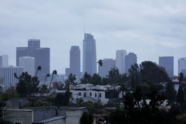
The National Weather Service in Los Angeles/Oxnard predicts that Southern California will experience widespread rainfall this week from Monday night to Wednesday due to the remnants of Tropical Storm Priscilla from the southwestern Pacific off the coast of Mexico.
According to the weather agency, the storm is expected to pass through the greater Los Angeles area from Monday to Wednesday, with most of the rainfall likely to occur from Monday night to Tuesday, bringing sustained widespread precipitation. Most areas may experience light to moderate rain, with some areas potentially experiencing heavy rain accompanied by thunderstorms and gusty winds. This storm system over the waters south of Santa Barbara, including Los Angeles County and Orange County, brings a 10% to 20% chance of thunderstorms.
The latest forecast from the National Weather Service on Sunday afternoon indicates that coastal and valley areas can expect 0.75 to 1.5 inches of rain, while mountain and foothill areas may receive 1.5 to 3.5 inches of rainfall. Given the southward airflow, some upslope areas could see higher rainfall amounts on Tuesday, reaching 0.5 to 1 inch per hour. Precipitation is expected to begin affecting areas such as Los Angeles, Orange County, Riverside County, and San Bernardino County from Monday night onwards, with continuous rainfall likely throughout Tuesday, starting from 3 am and lasting until 9 pm.
As the rain arrives, temperatures are expected to significantly decrease, with highs on Tuesday and Wednesday ranging from 60 to 70 degrees Fahrenheit. Snowfall is possible in higher elevations such as Big Bear Lake and Wrightwood.
During the storm’s passage, waters south of the Santa Barbara Channel, including Los Angeles County and coastal areas, may see a 10% to 20% chance of thunderstorms. These thunderstorms could be accompanied by lightning, gusty winds, small hail, and even waterspouts. Monday night and Tuesday night could see widespread southwesterly winds in Southern California, with a moderate chance of strong winds.
The peak times for rainfall in the areas affected by this storm system are as follows: starting from San Luis Obispo County (from Monday night at 10 pm to early Tuesday at 6 am), followed by Santa Barbara County, which is over 100 miles from Los Angeles (from early Tuesday at 1 am to 8 am), and then Ventura County (from early Tuesday at 5 am to noon); the peak rainfall period for Los Angeles County is from 9 am to 6 pm on Tuesday.
To prepare for the impact of the remnants of Tropical Storm Priscilla, Governor Newsom approved additional firefighting and rescue resources for Imperial County and San Bernardino County last Friday. The state government also advises residents to develop wildfire action plans, including familiarizing themselves with evacuation routes, preparing emergency kits, registering for emergency alerts, checking their family emergency plans, and checking on neighbors’ conditions.
While this rainfall will help alleviate the drought conditions in Southern California, the region’s precipitation levels remain below normal, indicating a continued state of drought.