
On Friday morning, a powerful earthquake measuring 7.6 on the Richter scale struck off the southern coast of the Philippines. The Philippine Institute of Volcanology and Seismology indicated that the earthquake could potentially trigger dangerous tsunamis in the nearby areas.
The epicenter was located in the sea about 62 kilometers (38 miles) southeast of Manay town in the Davao Oriental province, with a shallow depth of only 10 kilometers (6 miles), indicating shallow fault activity as the cause.
The Pacific Tsunami Warning Center in Honolulu mentioned that there could be hazardous waves within 300 kilometers (186 miles) of the epicenter. In some coastal areas near the epicenter in the Philippines, waves could be as high as 3 meters (10 feet) above normal tide levels, while Indonesia and Palau may experience smaller waves.
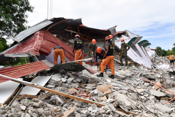
The Philippines is still reeling from a magnitude 6.9 earthquake that struck on September 30. The disaster in Cebu province claimed the lives of at least 74 people, displacing thousands, with Bogo City and surrounding towns bearing the brunt of the impact.
Sitting on the Pacific Ring of Fire, the Philippines is one of the most disaster-prone countries in the world. This seismic belt around the Pacific Ocean frequently experiences earthquakes and volcanic eruptions.
Moreover, the archipelagic nation is also besieged by around 20 typhoons and storms annually, making disaster preparedness and response a significant undertaking for both the government and volunteer groups.